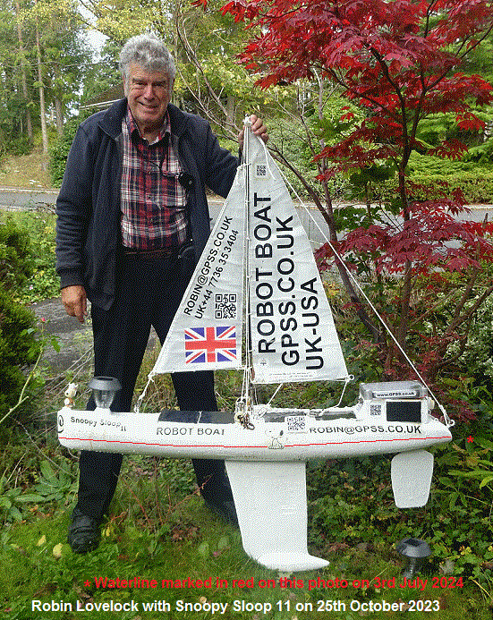
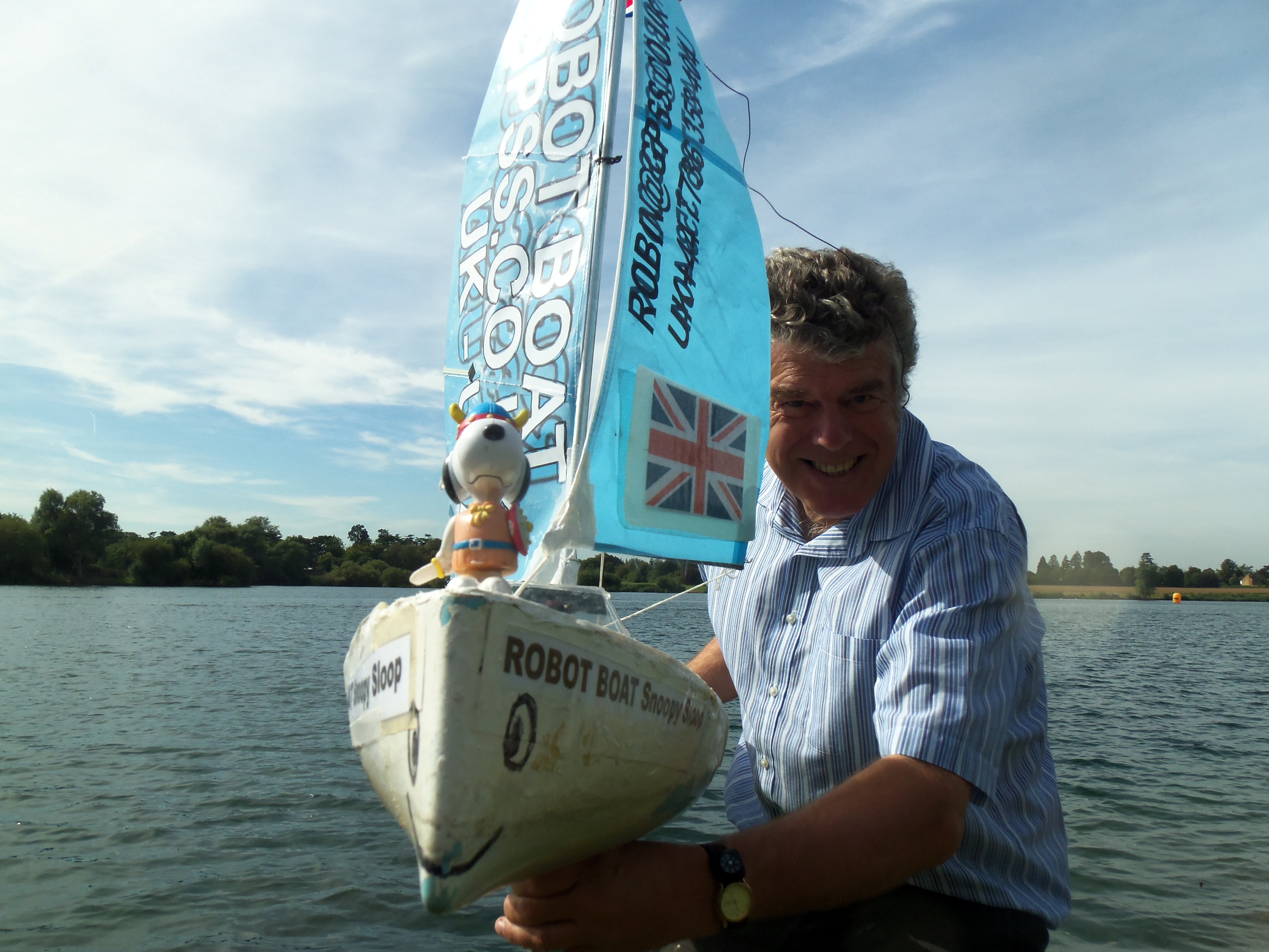
1. Introduction by Robin ...

 I'm Robin Lovelock, and the Press have described me as a "retired NATO scientist".
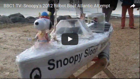
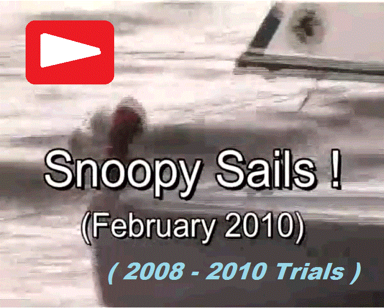
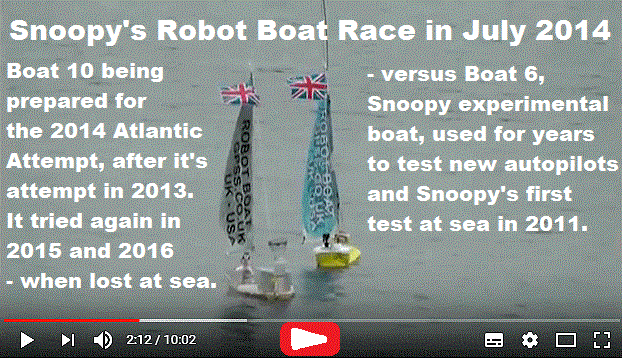
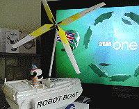
Snoopy's first attempt was in 2012, and broadcast live on BBC TV. Play that video on the right :-)
I'm Robin Lovelock, and the Press have described me as a "retired NATO scientist".
Snoopy's first attempt was in 2012, and broadcast live on BBC TV. Play that video on the right :-)
I set up this "Snoopy" page in early 2008, when I started this crazy hobby project: developing a small robot boat, capable of sailing itself
across the Atlantic, from UK to USA. My local friend John Sylvester got me started, telling me about the
friendly Microtransat international competition, and I was soon hooked. John gave us our name "Team-Joker".
It was Yves Briere in France,
who first suggested the idea in 2004, at a conference. Their early attempts fired my enthusiasm.
There is more about me, our family, my earlier defence systems career, then GPS software business - now a hobby,
on my
Home page.
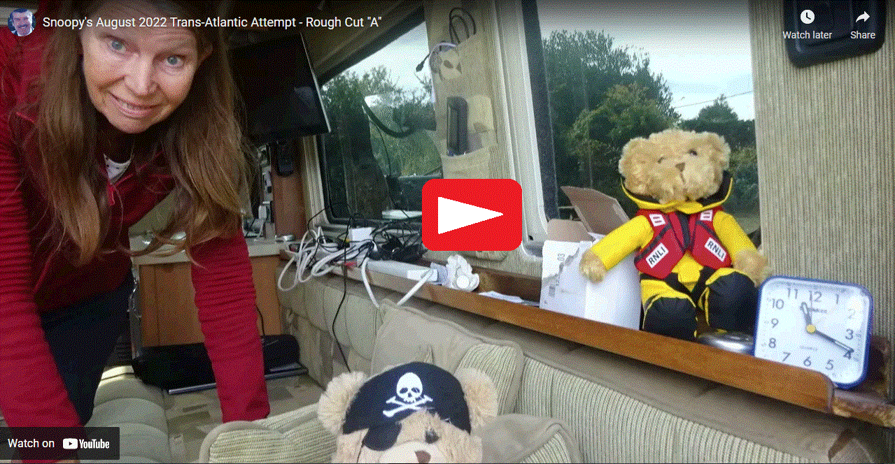
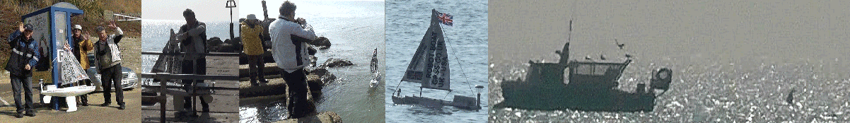
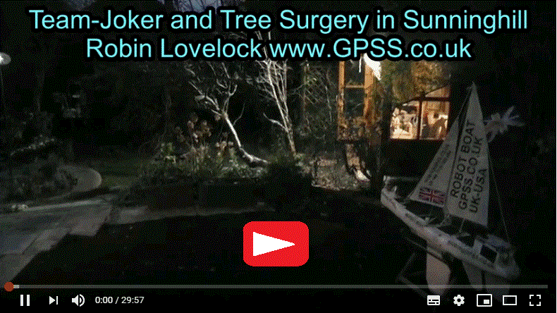
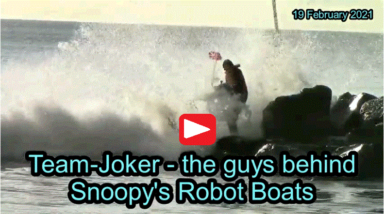 This Team-Joker Guys video below was made in October 2018, and tells you a little
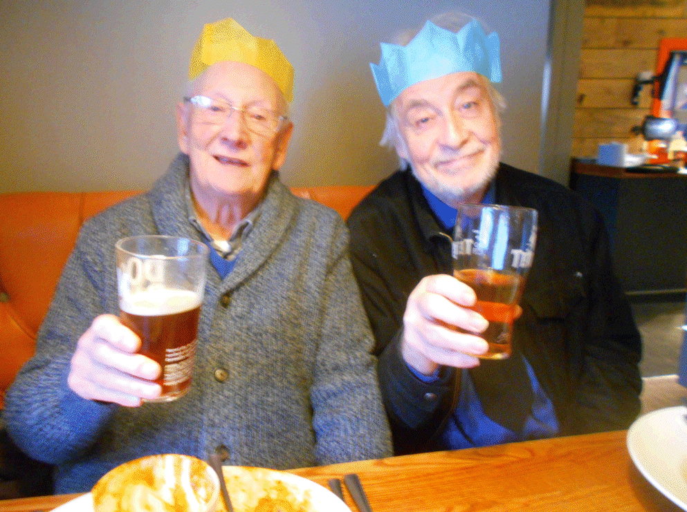
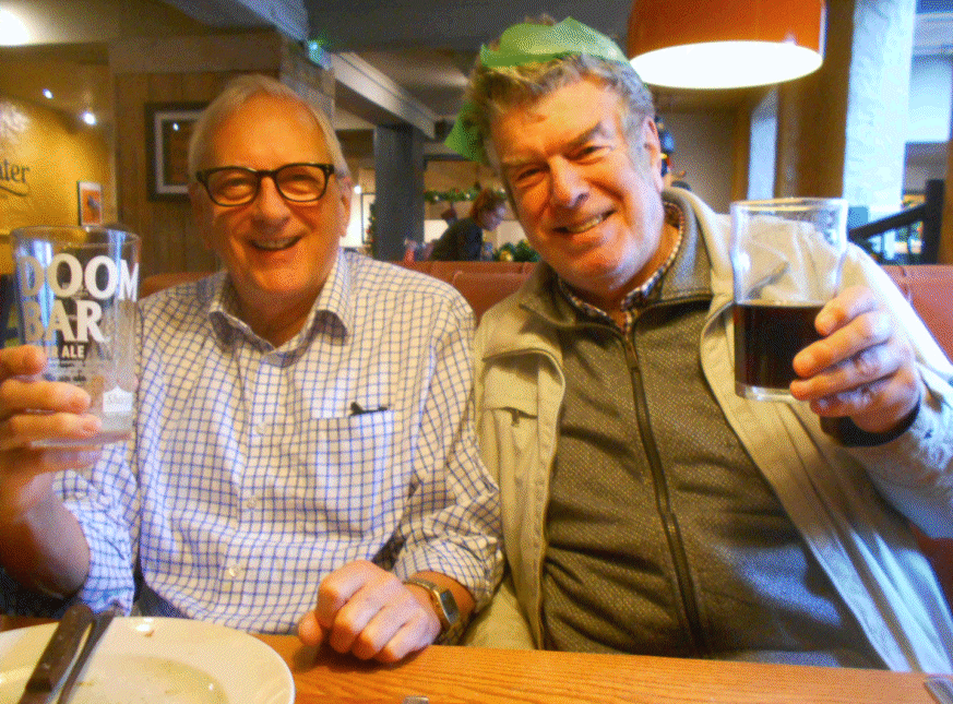
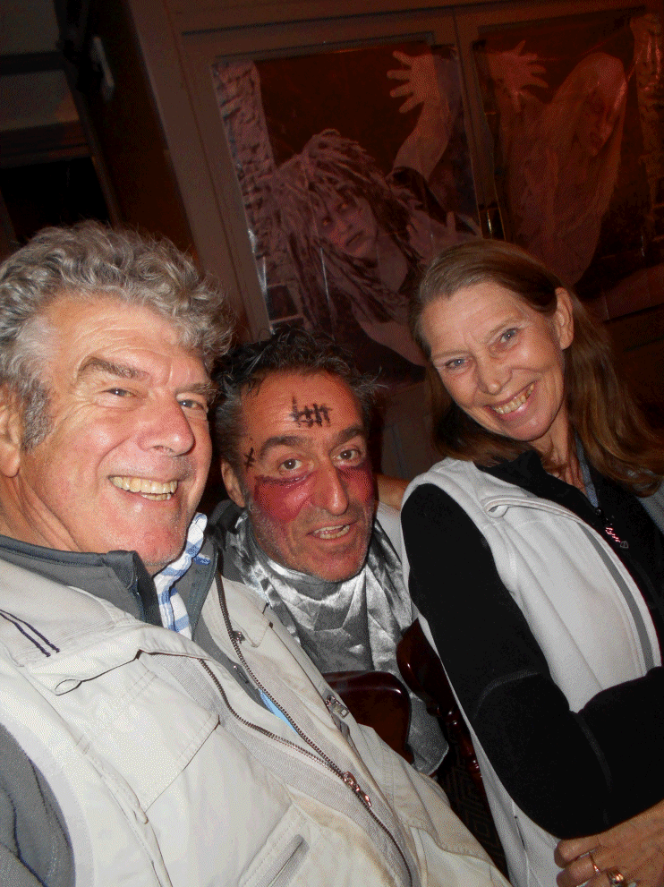
about the guys working with me on Snoopy's Trans-Atlantic Attempts. Important guys Dick & Peter made contact after that 2012 Publicity :-)
This Team-Joker Guys video below was made in October 2018, and tells you a little
about the guys working with me on Snoopy's Trans-Atlantic Attempts. Important guys Dick & Peter made contact after that 2012 Publicity :-)
It is many decades since our academic years,
and, since retiring, we are now all too busy for paid work :-)
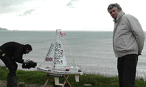
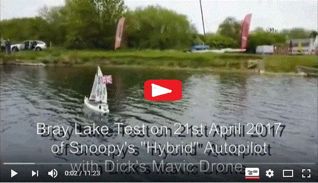
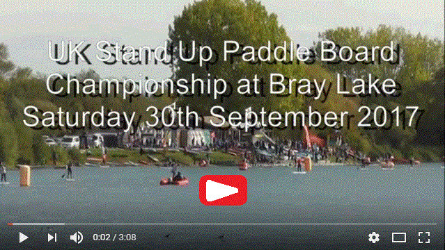
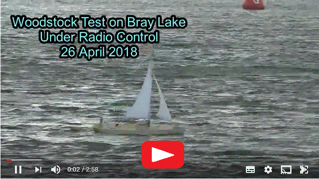
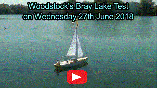
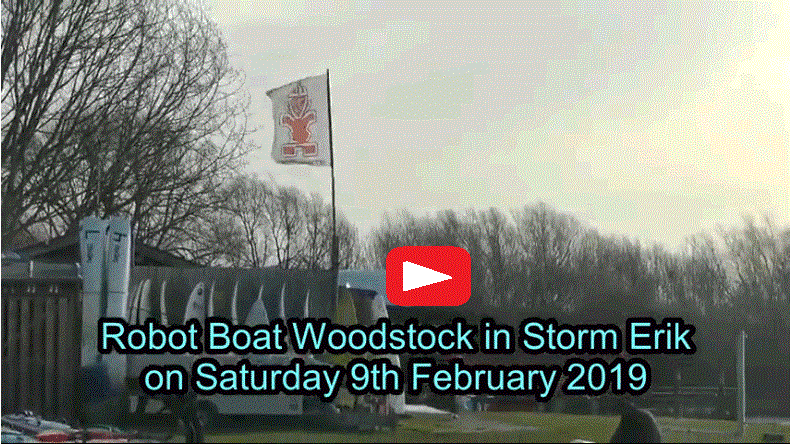
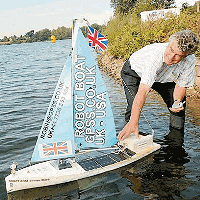
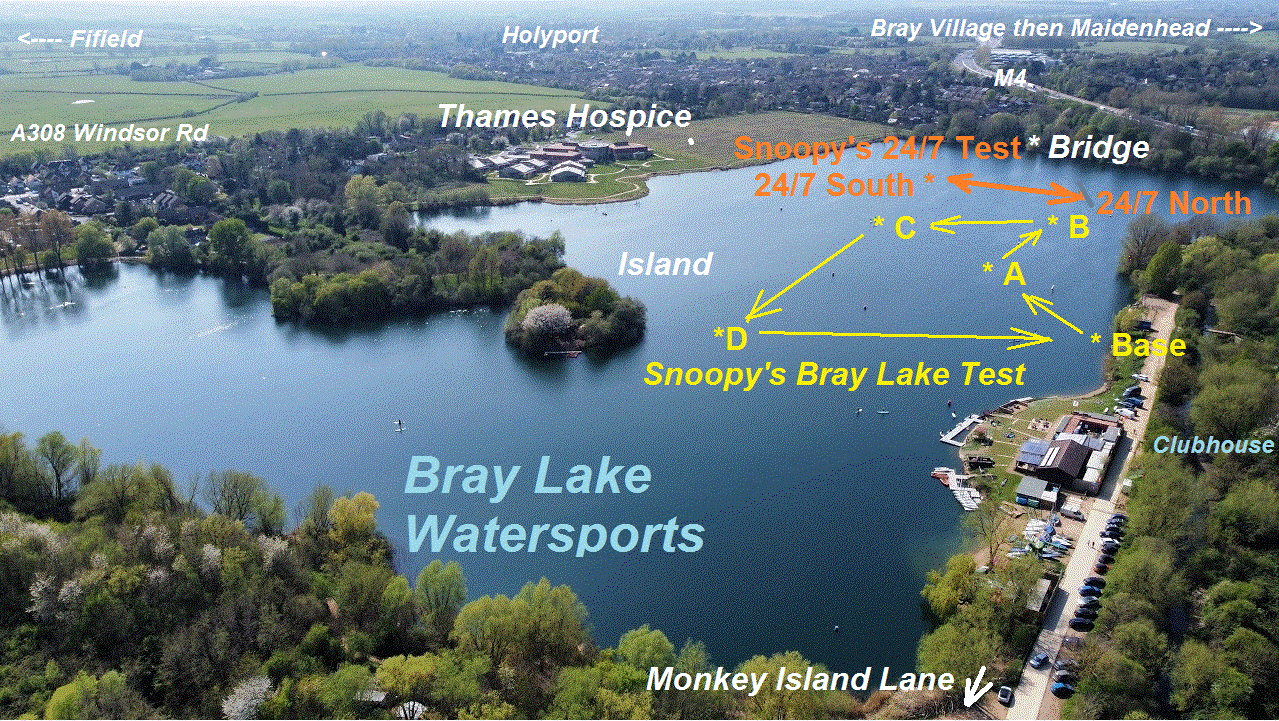
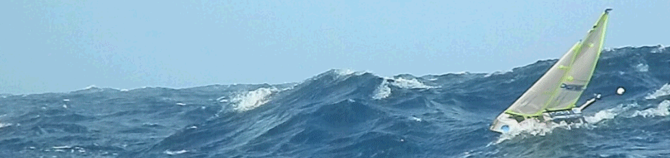
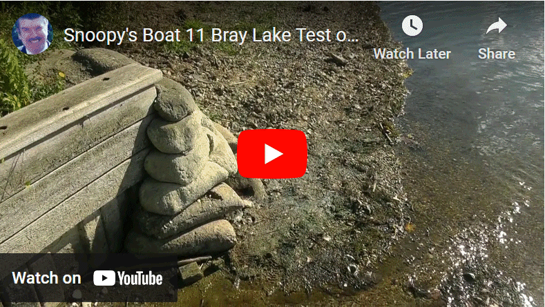 That video on the right shows Snoopy's Robot boat being given a "Bray Lake Test", before making an Atlantic Attempt.
Bray Lake is the "lake in Berkshire" mentioned on that 2012 BBC TV broadcast, and was already important to Robin
in an earlier project: GPS bottles to be thrown into the sea off Ramsgate, to sail "around the World" - or at least
as far as Holland ! :-)
That video on the right shows Snoopy's Robot boat being given a "Bray Lake Test", before making an Atlantic Attempt.
Bray Lake is the "lake in Berkshire" mentioned on that 2012 BBC TV broadcast, and was already important to Robin
in an earlier project: GPS bottles to be thrown into the sea off Ramsgate, to sail "around the World" - or at least
as far as Holland ! :-)
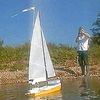
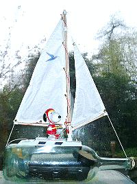 Tap or Click on Snoopy sailing a bottle for this earlier hobby project:
tracking
GPS Bottles thrown into the sea. We learnt a lot about wind and tide
- very applicable to robot boats !
After browsing this page
and others, you can form your own opinion on myself and these rather challenging projects.
Tap or Click on Snoopy sailing a bottle for this earlier hobby project:
tracking
GPS Bottles thrown into the sea. We learnt a lot about wind and tide
- very applicable to robot boats !
After browsing this page
and others, you can form your own opinion on myself and these rather challenging projects.
I give this page a "tidy-up" when I can, moving material onto other linked pages. Over the years I've found it valuable,
despite it's limitations, to save everybody's time, when chatting to me directly: I am a very slow email typer ! These pages should be
of help to all in contact with me, including journalists and friends helping, both near me in UK, and in far off countries.
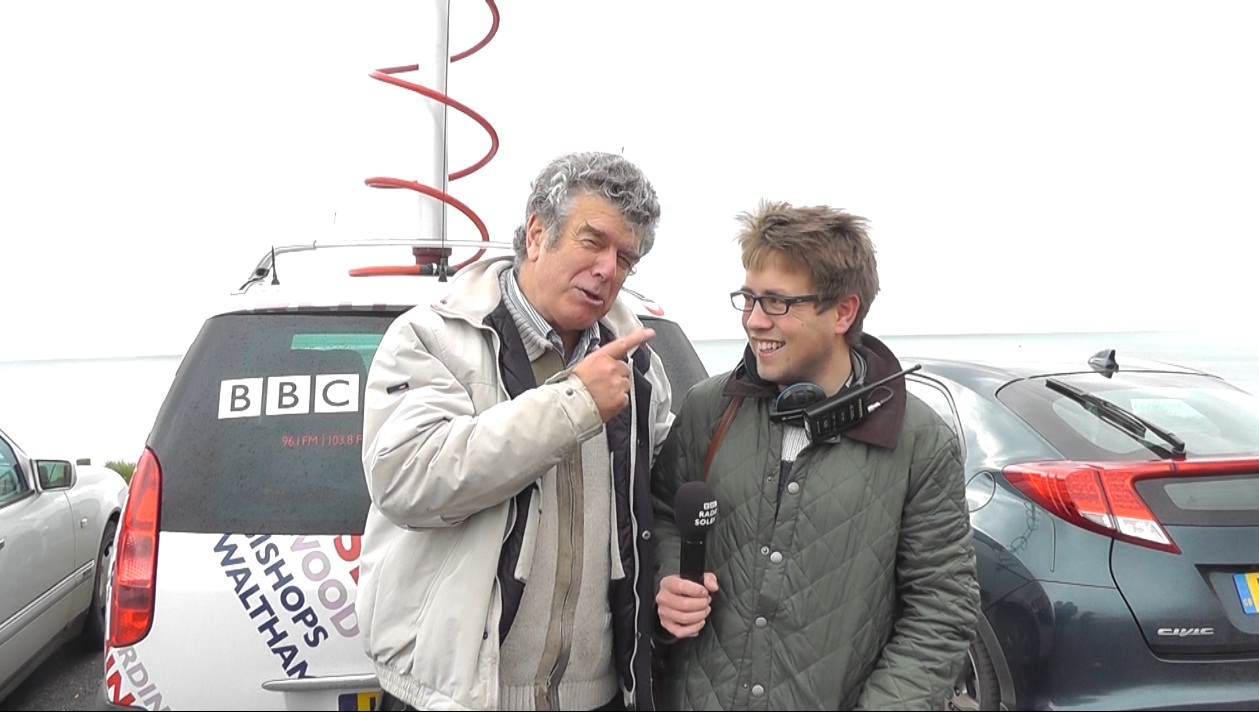
Many of my friends now providing invaluable help, first made contact with me after seeing the BBC TV South broadcast,
or a Newspaper article. Thank you everybody ! :-)
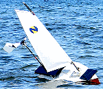
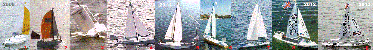
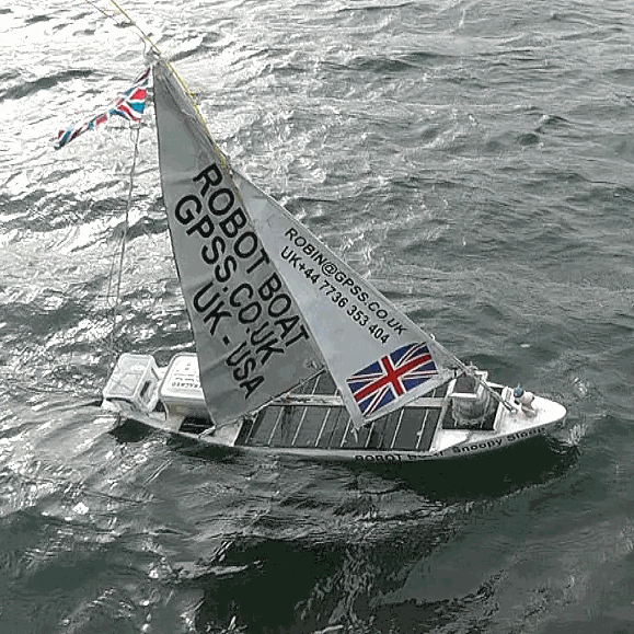
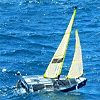 That's a French boat on the right and at the very top of this page.
Below that is the 2014 American boat.
Click on these pictures for the French and USA teams - also with small boats.
From there you can go to other Microtransat pages, maintained by Aberystwyth University in UK.
Their web site has been the focus for this activity since 2005,
after Dr Mark Neal, at the University, and Yves, conceived the "Microtransat Challenge".
Their site includes the rules, teams "competing", and tracking of their robot boats.
Over the years, several teams have tried, but all
these heroic attempts only survived a few days or a few hundred miles.
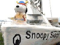
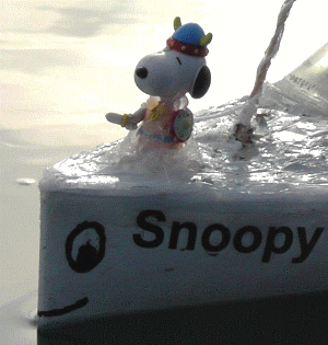
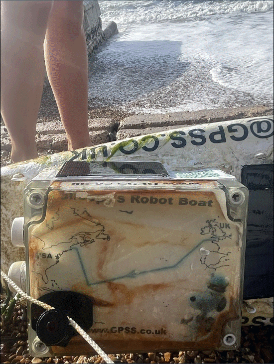
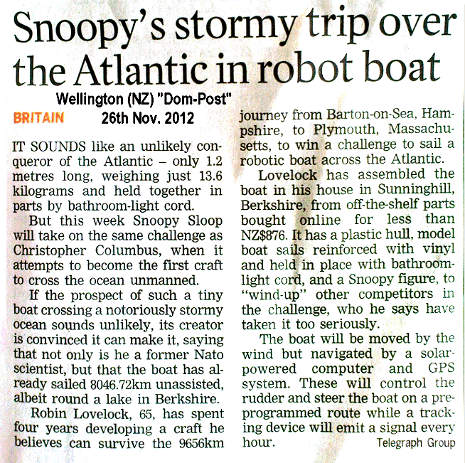
A journalist pointed out to me, in 2012, that Snoopy had already sailed over 5,000 miles, during our reliability testing of him on Bray Lake
in 2012. Snoopy has done a lot more sailing since then,
and that's why I am confident Snoopy has as much chance as the other teams ! :-)
That's a French boat on the right and at the very top of this page.
Below that is the 2014 American boat.
Click on these pictures for the French and USA teams - also with small boats.
From there you can go to other Microtransat pages, maintained by Aberystwyth University in UK.
Their web site has been the focus for this activity since 2005,
after Dr Mark Neal, at the University, and Yves, conceived the "Microtransat Challenge".
Their site includes the rules, teams "competing", and tracking of their robot boats.
Over the years, several teams have tried, but all
these heroic attempts only survived a few days or a few hundred miles.
A journalist pointed out to me, in 2012, that Snoopy had already sailed over 5,000 miles, during our reliability testing of him on Bray Lake
in 2012. Snoopy has done a lot more sailing since then,
and that's why I am confident Snoopy has as much chance as the other teams ! :-)
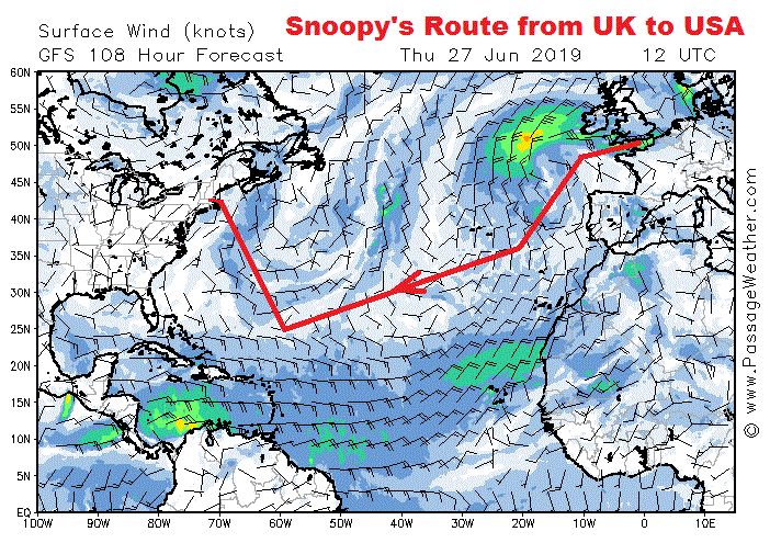
 You will find links below to more detailed pages, amusing TV broadcasts, newspaper articles, and home videos, of Snoopy's attempts
on the Atlantic since November 2012.
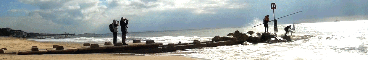
Watch our attempts to "beat the surf" in March 2013: now we know how to do it - with Magic Seaweed !
Later in 2013, and in 2014, Snoopy made Atlantic attempts, but these ended up on the Isle of Wight,
with the same boat being rescued by Dick, with little damage.
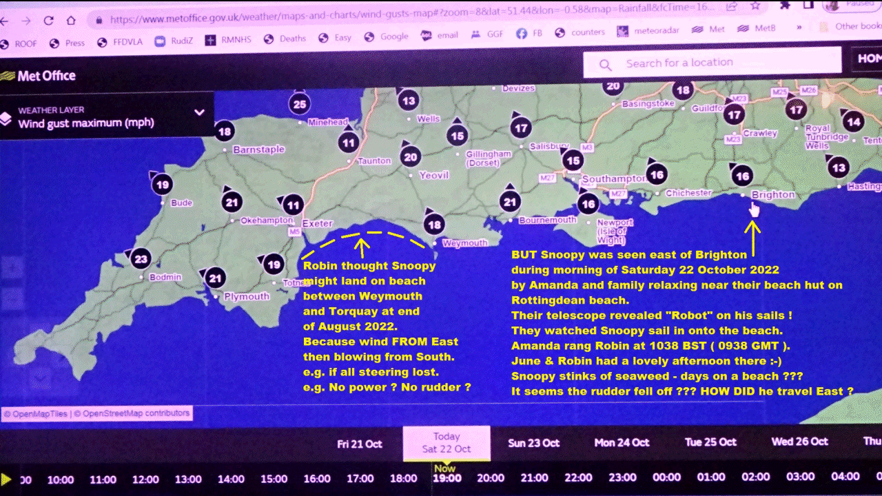
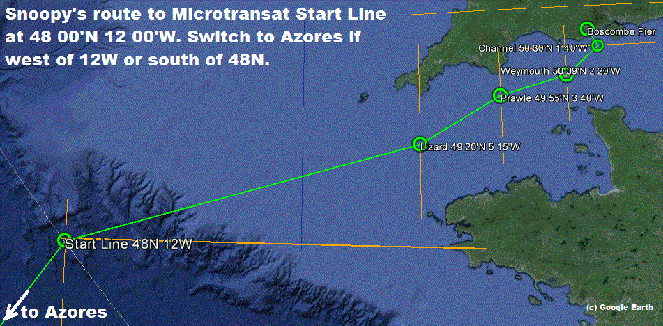
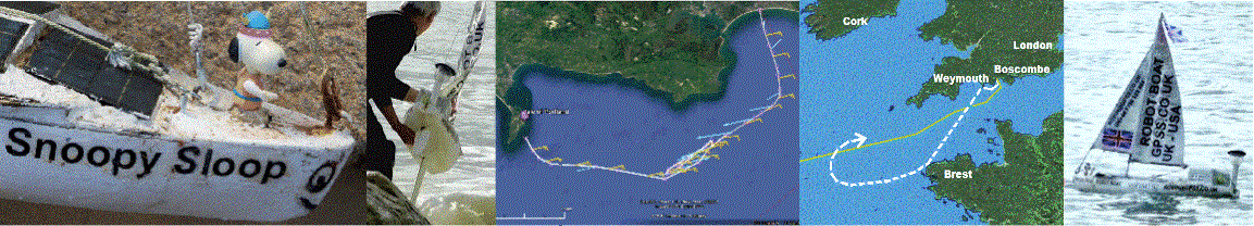
The Attempt on 30th November 2014, was better: Snoopy got as far as Weymouth, but
crash landed near Portland Bill - undamaged.
You will find links below to more detailed pages, amusing TV broadcasts, newspaper articles, and home videos, of Snoopy's attempts
on the Atlantic since November 2012.
Watch our attempts to "beat the surf" in March 2013: now we know how to do it - with Magic Seaweed !
Later in 2013, and in 2014, Snoopy made Atlantic attempts, but these ended up on the Isle of Wight,
with the same boat being rescued by Dick, with little damage.
The Attempt on 30th November 2014, was better: Snoopy got as far as Weymouth, but
crash landed near Portland Bill - undamaged.
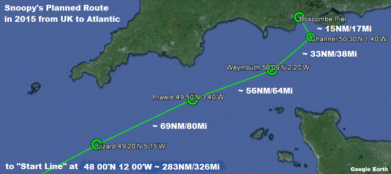
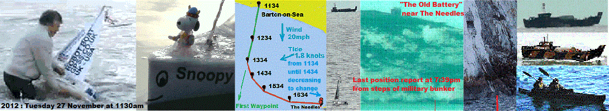
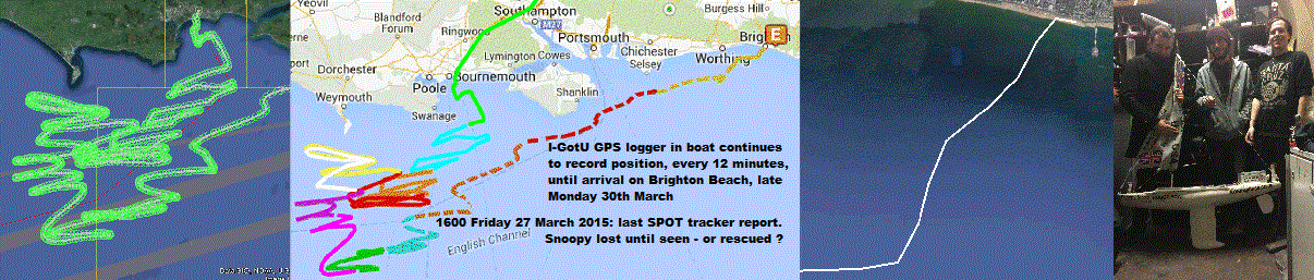
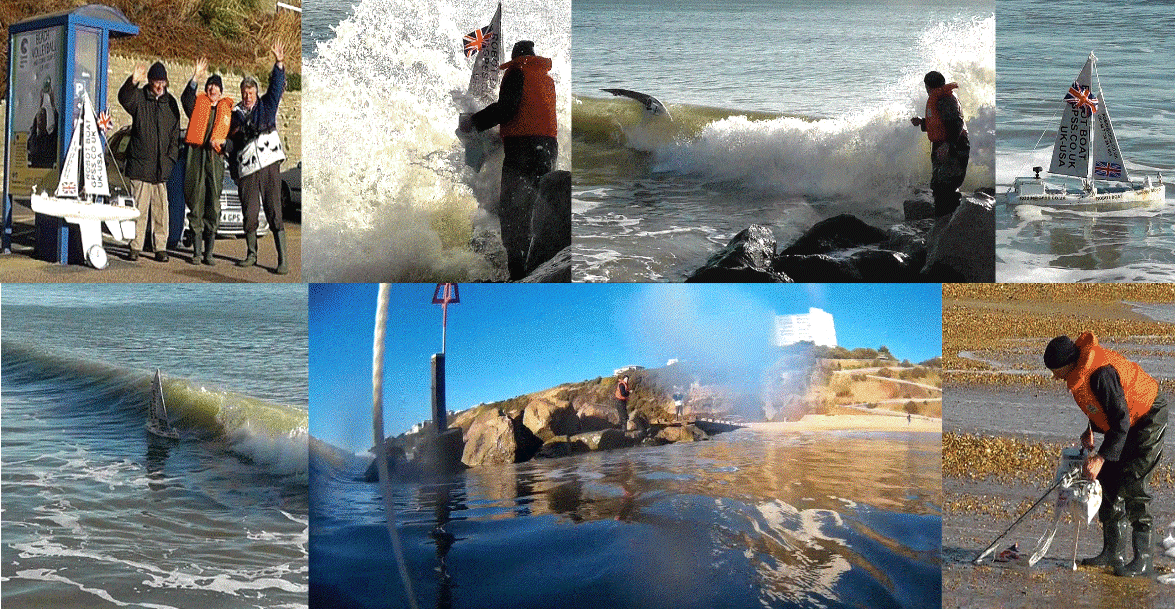
 The same boat tried again in March 2015,
and this was the best attempt yet - and the most interesting of all. Who did that "rescue at sea",
with Snoopy ending up at a Brighton Night Club ?
Snoopy's very first attempt was in 2012, and that was, until 2015,
the most mysterious story of all - we never did find where he went, after visiting that old military bunker
on the Isle of Wight :-)
The same boat tried again in March 2015,
and this was the best attempt yet - and the most interesting of all. Who did that "rescue at sea",
with Snoopy ending up at a Brighton Night Club ?
Snoopy's very first attempt was in 2012, and that was, until 2015,
the most mysterious story of all - we never did find where he went, after visiting that old military bunker
on the Isle of Wight :-)
Most of Team-Joker friends, and myself, can only spend a small ammount of our time on this Robot Boat hobby.
See my
Home
page and that "Bigger Picture".
Or just see very recent videos on my Youtube channel:
www.youtube.com/user/RobinLovelock/videos
We are still getting out and about, with Robin getting up to mischief :-)

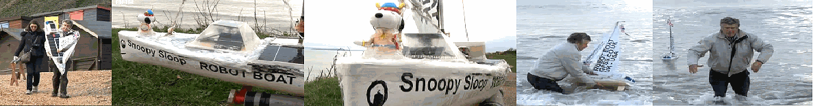
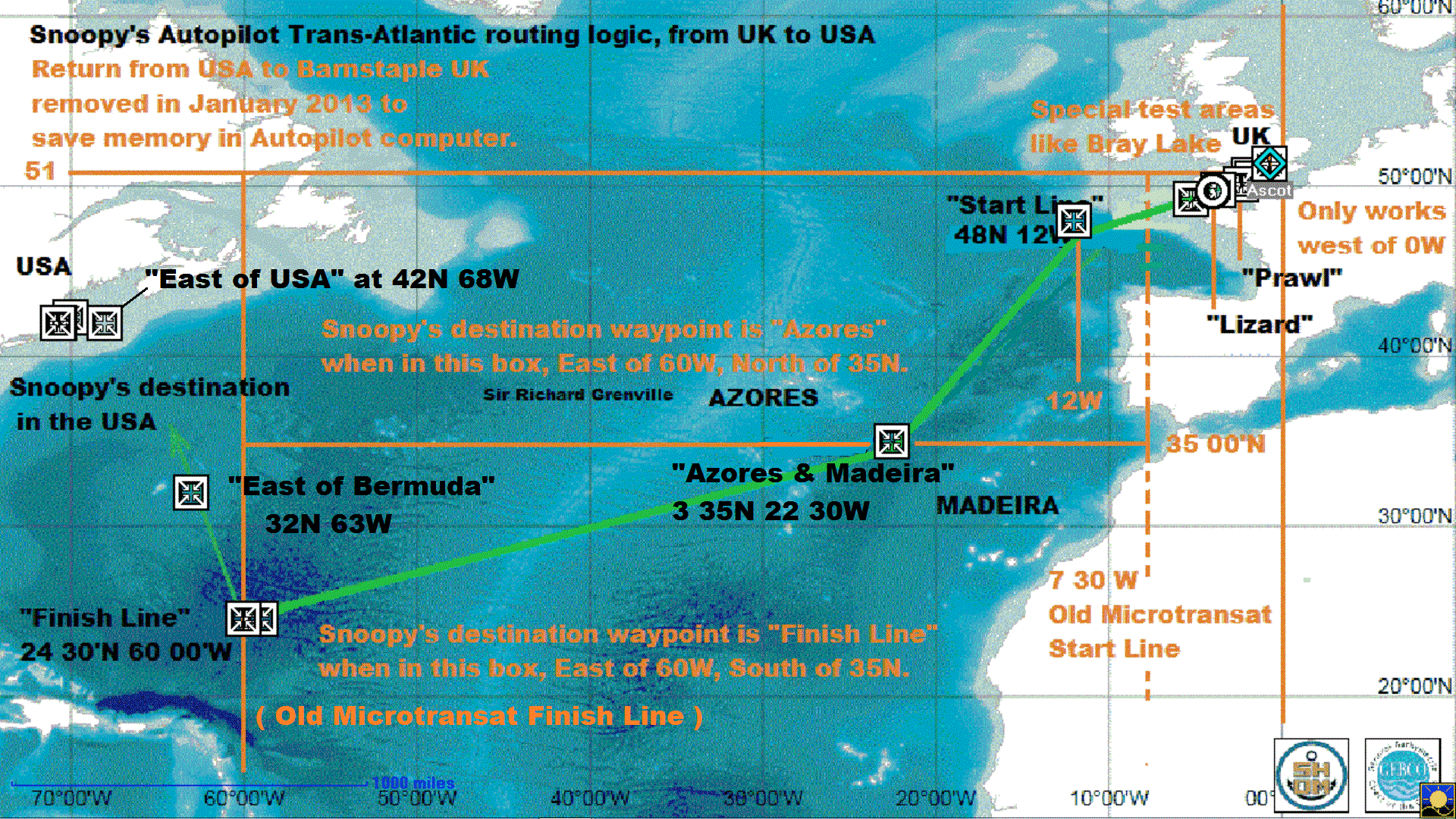
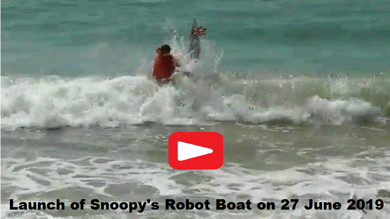
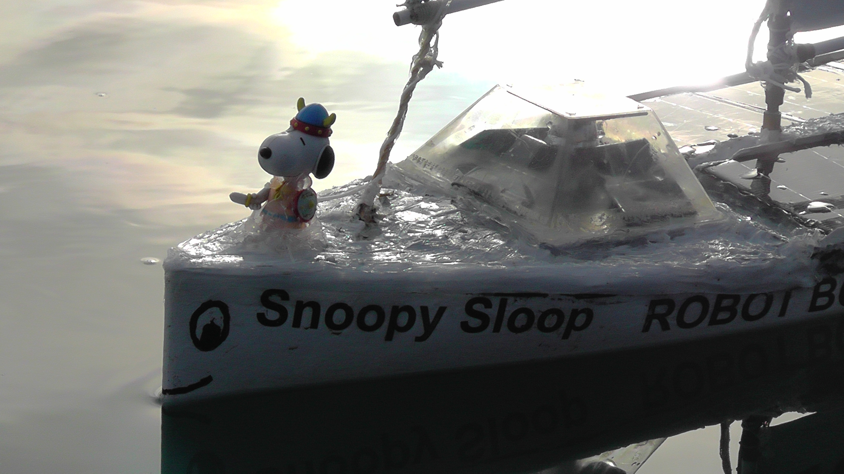
 Snoopy the Viking will attempt the Atlantic again, from UK to USA, in his little robot boat.
The "Microtransat Challenge"
is a French idea.
Snoopy the Viking will attempt the Atlantic again, from UK to USA, in his little robot boat.
The "Microtransat Challenge"
is a French idea.


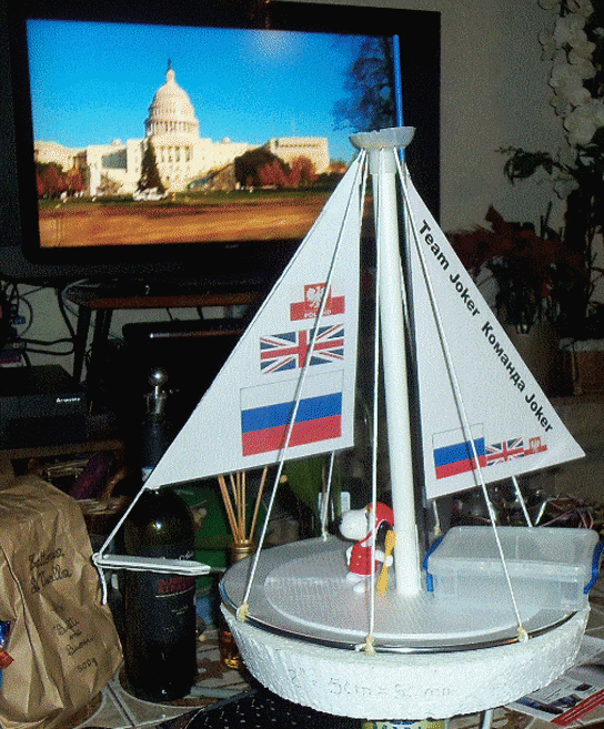

 "Hi Guys ! I've lived so many years in Europe, I hope you don't think that I have "gone native".
These clothes were given me by McDonalds, when they gave out clones of me around the World,
and they are appropriate: Vikings were the first to reach American shores,
long before the French or British. I'm looking forward to coming back home to my mother-land of USA,
if and when that idiot Robin succeeds in making me a suitable boat. Sorry about his insistence
in our boats flying the British Flag: I'm sure he is only doing it to annoy you.
I often hear him muttering, 'we should never have worn red, and marched in a straight line'!
I hope to see you soon: I will give you plenty of warning !"
"Hi Guys ! I've lived so many years in Europe, I hope you don't think that I have "gone native".
These clothes were given me by McDonalds, when they gave out clones of me around the World,
and they are appropriate: Vikings were the first to reach American shores,
long before the French or British. I'm looking forward to coming back home to my mother-land of USA,
if and when that idiot Robin succeeds in making me a suitable boat. Sorry about his insistence
in our boats flying the British Flag: I'm sure he is only doing it to annoy you.
I often hear him muttering, 'we should never have worn red, and marched in a straight line'!
I hope to see you soon: I will give you plenty of warning !"
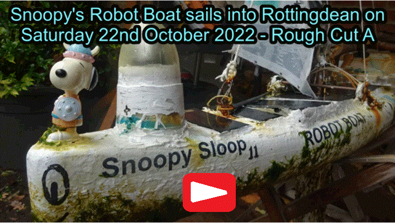


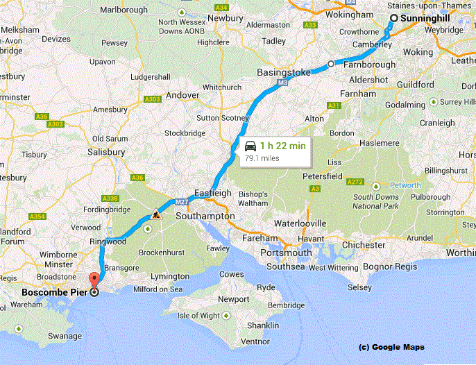
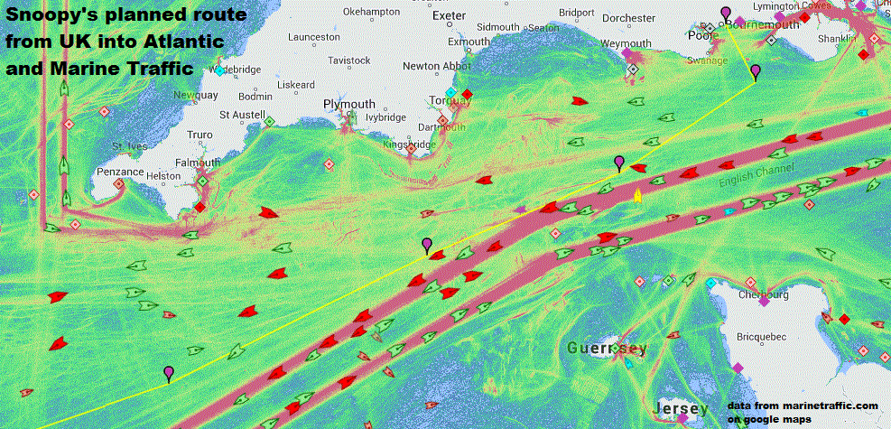
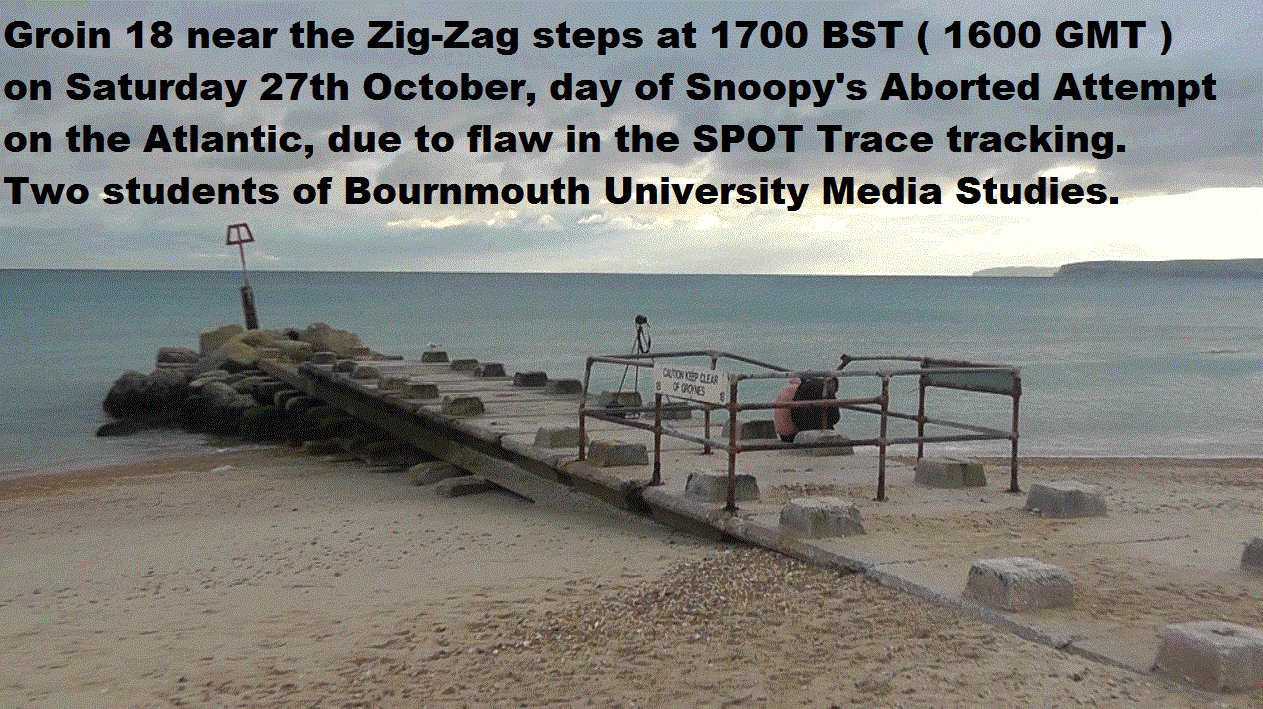
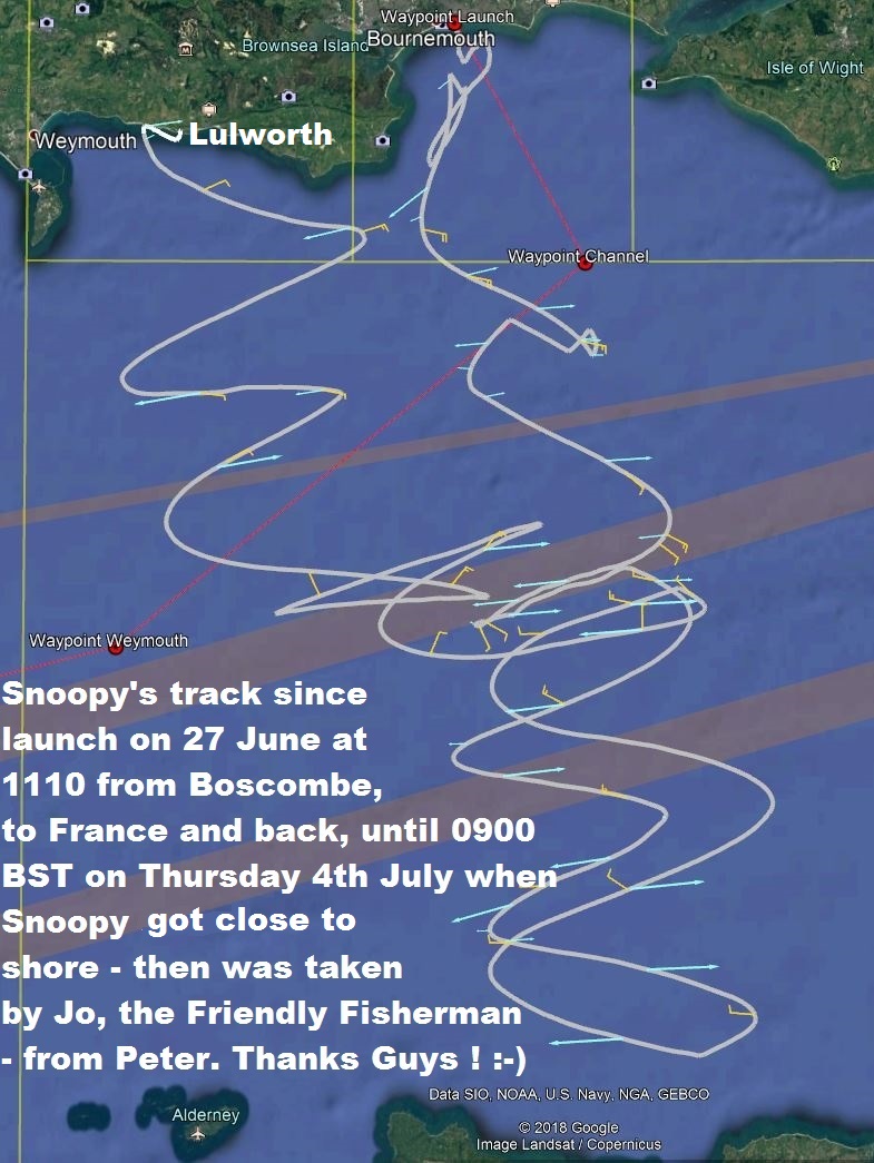
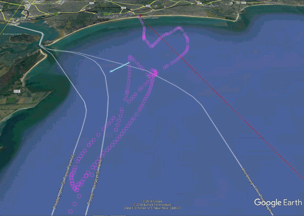
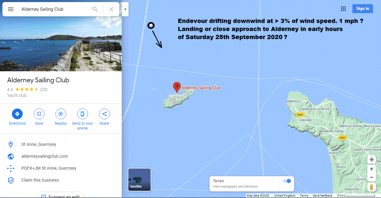
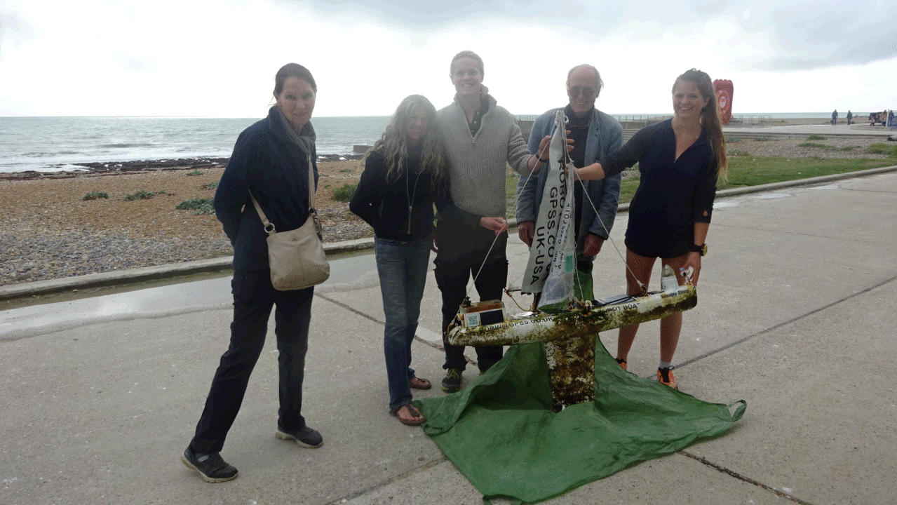
 In short: Snoopy surprised us by sailing south to Cherbourg, on the French Coast, chased by Dick with bicycle on a cross-channel ferry;
but then Snoopy changed his mind and turned back, followed by Dick. Peter and Dick collected Snoopy from Lulworth Cove and the boat
is now safely at Robin's home in Sunninghill.
In short: Snoopy surprised us by sailing south to Cherbourg, on the French Coast, chased by Dick with bicycle on a cross-channel ferry;
but then Snoopy changed his mind and turned back, followed by Dick. Peter and Dick collected Snoopy from Lulworth Cove and the boat
is now safely at Robin's home in Sunninghill.
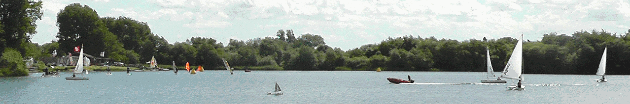
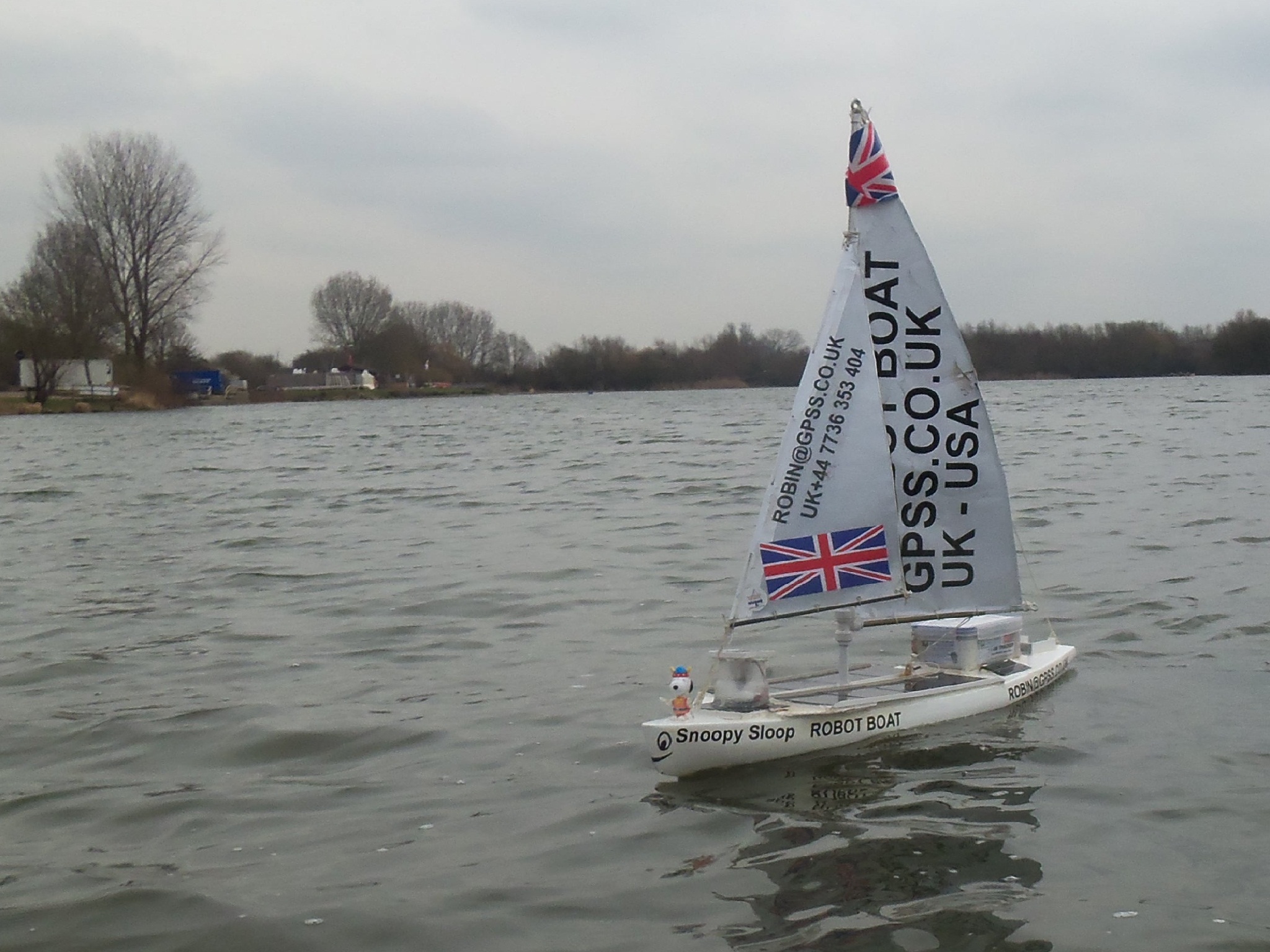
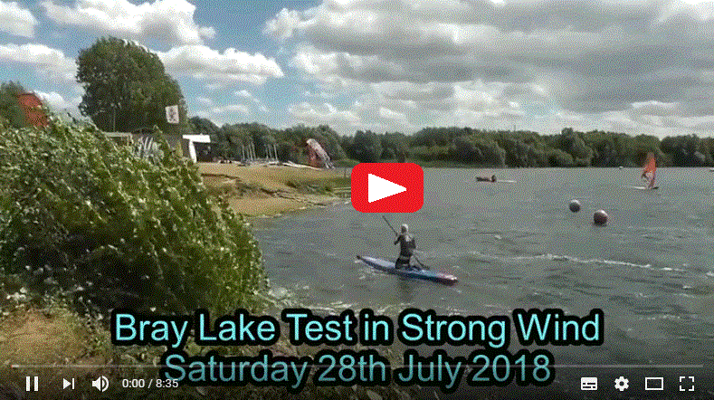
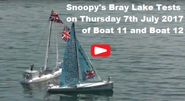
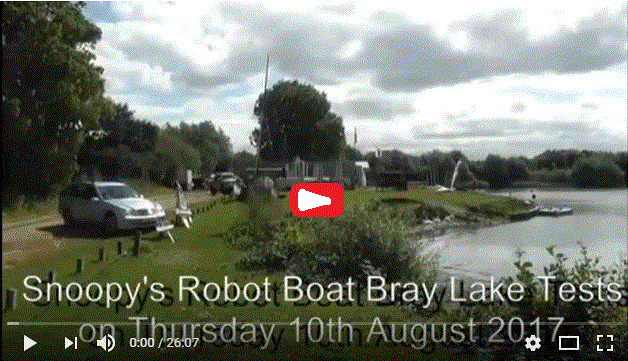
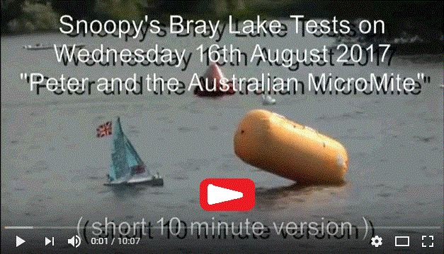
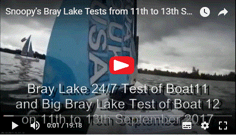
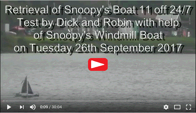
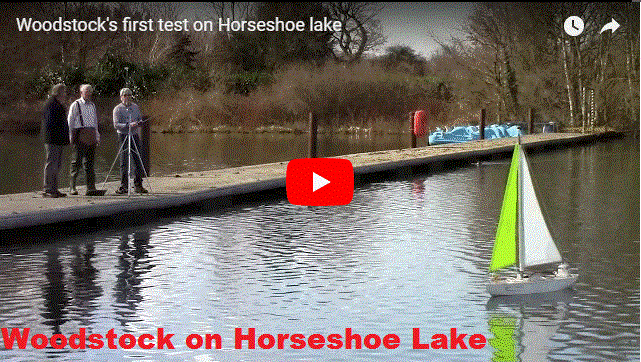
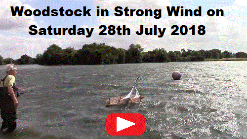
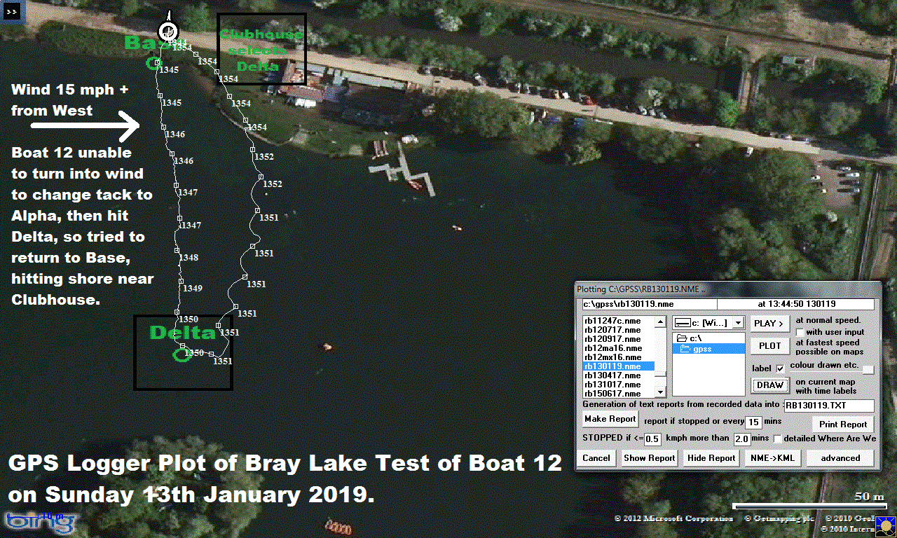
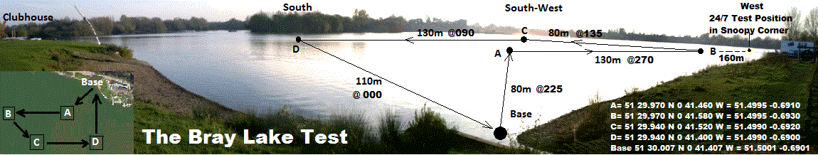
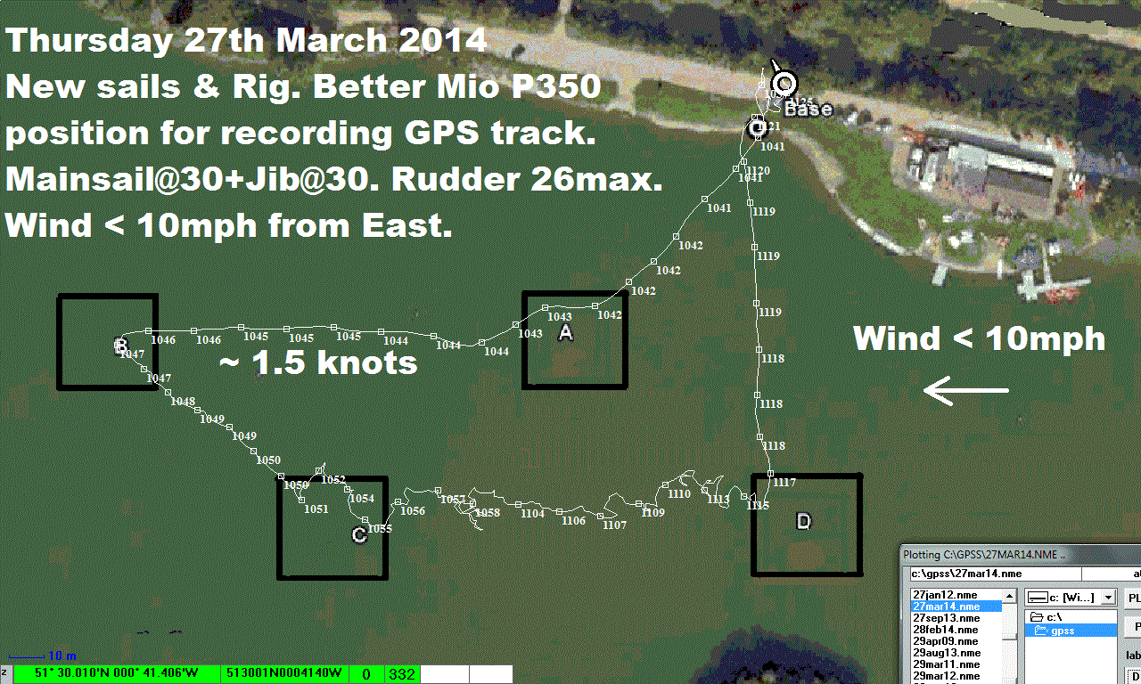
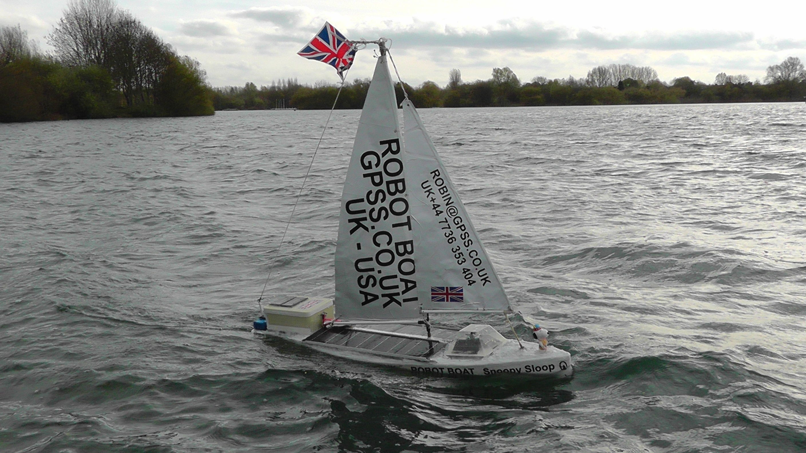
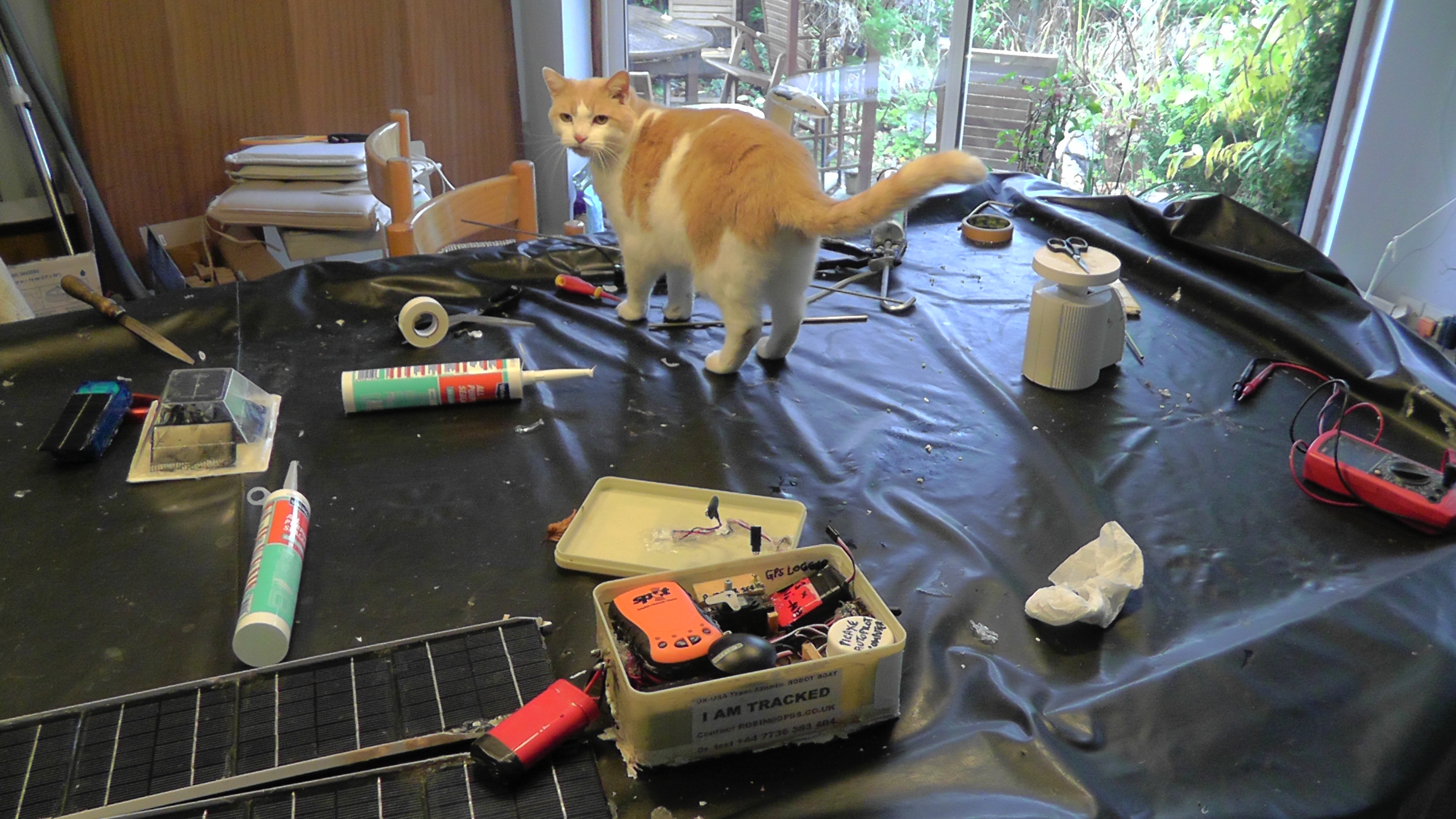
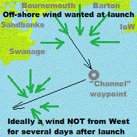 Every boat starts with weeks, or even months, of testing on Bray Lake.
Each year we wait for a suitable "Weather Window",
with FLAT surf, an offshore breeze from the North,
and a minimum of three for our launch team,
avoiding holidays, etc.
We watch
Every boat starts with weeks, or even months, of testing on Bray Lake.
Each year we wait for a suitable "Weather Window",
with FLAT surf, an offshore breeze from the North,
and a minimum of three for our launch team,
avoiding holidays, etc.
We watch
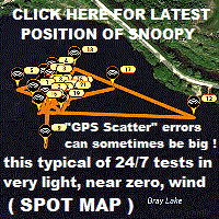
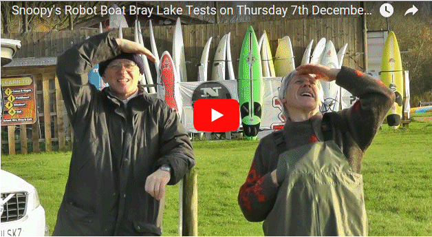
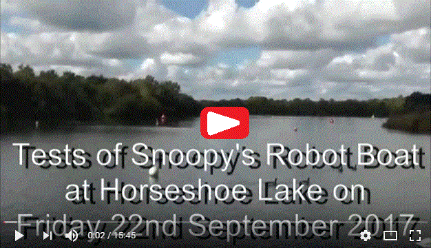
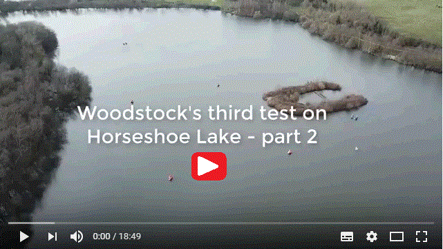
 Before making an Atlantic attempt, Snoopy has several weeks of "24/7 tests", to ensure all the boat is reliable.
Snoopy sailed over 5,000 miles on Bray Lake in 2012, and has sailed a lot further since then !
If the wind drops
to below about 1mph - as often happens at night -
Snoopy "goes for a wander". If he gets stuck
near the shore, Robin goes over to push Snoopy out again.
Before making an Atlantic attempt, Snoopy has several weeks of "24/7 tests", to ensure all the boat is reliable.
Snoopy sailed over 5,000 miles on Bray Lake in 2012, and has sailed a lot further since then !
If the wind drops
to below about 1mph - as often happens at night -
Snoopy "goes for a wander". If he gets stuck
near the shore, Robin goes over to push Snoopy out again.
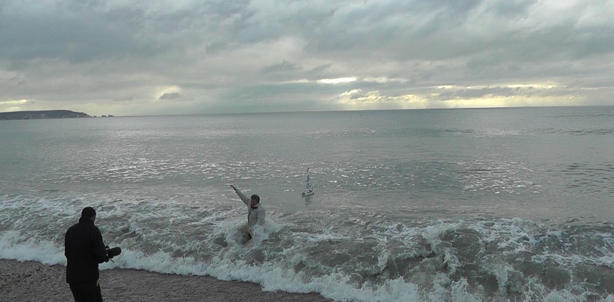
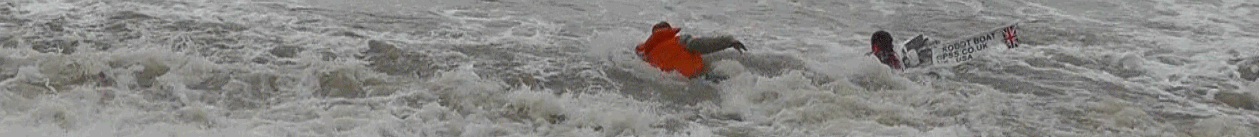 In brief: Snoopy tried, but failed to get away
from the beach, in waves that were bigger than on his 2012 attempt. He went home, to sail another day - in calmer conditions ! :-)
In brief: Snoopy tried, but failed to get away
from the beach, in waves that were bigger than on his 2012 attempt. He went home, to sail another day - in calmer conditions ! :-)
 In brief: Snoopy launched at 1215pm Friday 11th, wandered, landed about 3am Saturday, was rescued at 8am. Faulty rudder linkage ?
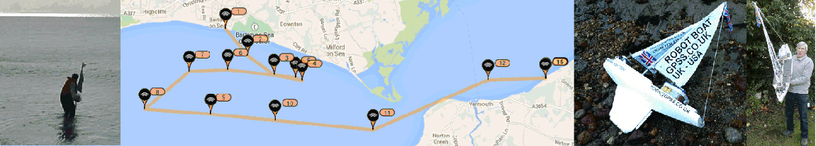
 In brief: Snoopy launched at 0850 Saturday 6th in little wind, wandered, landed Sunday morning and rescued. Not enough wind ?
Need a launch spot further west ?
In brief: Snoopy launched at 0850 Saturday 6th in little wind, wandered, landed Sunday morning and rescued. Not enough wind ?
Need a launch spot further west ?
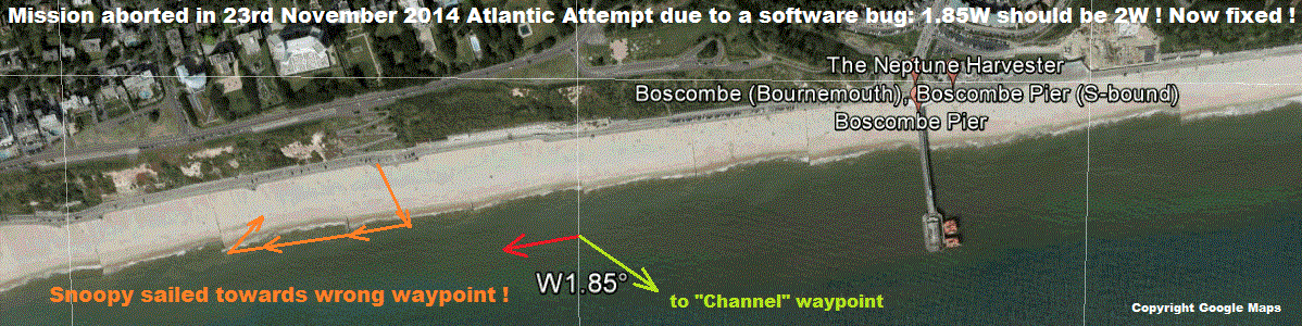 In brief: Snoopy launched at 0830 Sunday 23rd from new spot near Bournemouth: he simply sailed parallel to the beach,
due to a software bug, now fixed.
In brief: Snoopy launched at 0830 Sunday 23rd from new spot near Bournemouth: he simply sailed parallel to the beach,
due to a software bug, now fixed.
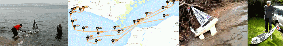
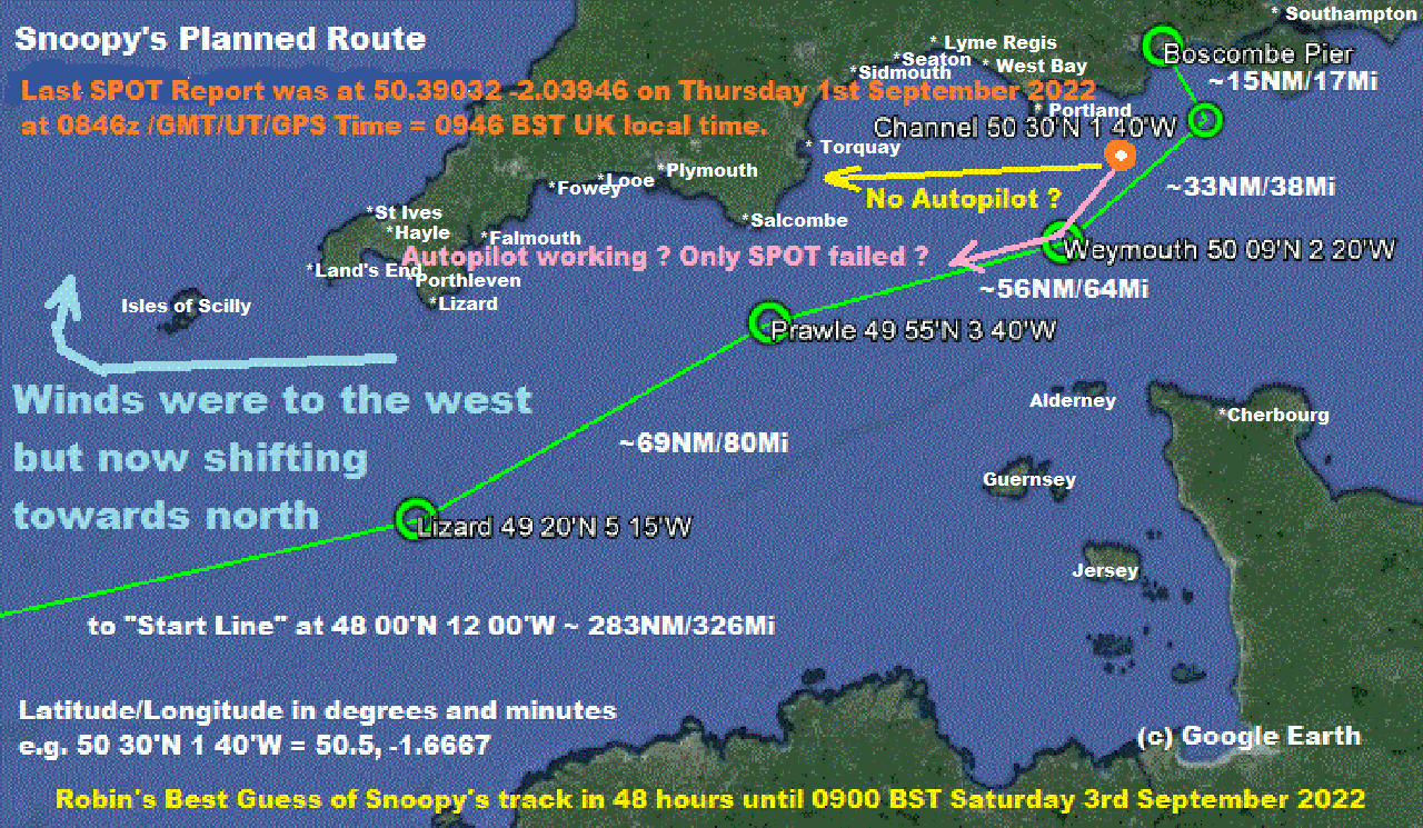
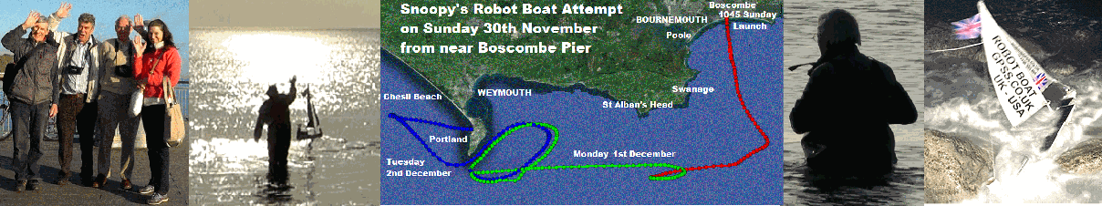 In brief: Snoopy launched at 1045 Sunday 30th November from Boscombe Pier. Crash landed on rocks at Portland on Tuesday night.
Rescued by Dick almost undamaged.
In brief: Snoopy launched at 1045 Sunday 30th November from Boscombe Pier. Crash landed on rocks at Portland on Tuesday night.
Rescued by Dick almost undamaged.

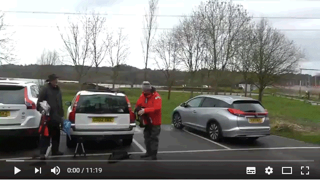
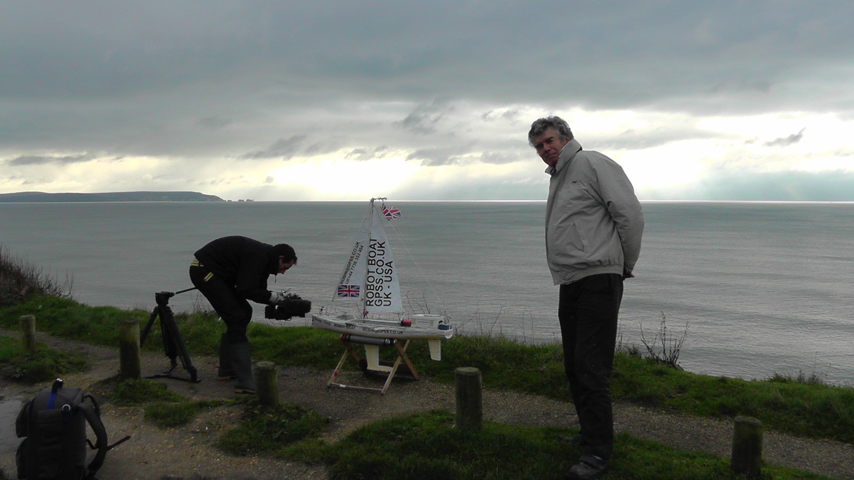
 Robin has added this section, which may be of interest to journalists, who want to "tag along" to get some photos or video.
It may also be of help to dog-walkers, who probably wonder why that strange man, seems to be talking to himself,
and listening to several radios on the roof of his car.
Robin has added this section, which may be of interest to journalists, who want to "tag along" to get some photos or video.
It may also be of help to dog-walkers, who probably wonder why that strange man, seems to be talking to himself,
and listening to several radios on the roof of his car.
 Robin normally avoids days when it is raining, or when there is no wind at all. He therefore checks web sites like
the Met Office, RainToday, and the Maidenhead Sailing Club web cam.
Robin normally avoids days when it is raining, or when there is no wind at all. He therefore checks web sites like
the Met Office, RainToday, and the Maidenhead Sailing Club web cam.
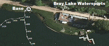 Most people park on the right, just before the club house, but Robin has the combination to the
barrier, so parks his car near the "Base", a few yards past the club house.
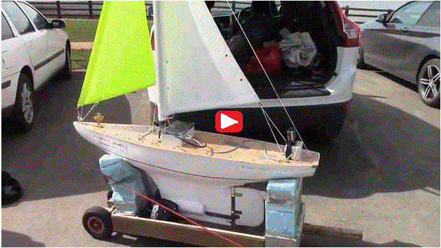
Snoopy is usually launched within 5 minutes of Robin arriving. First Robin switches on the Pocket PC,
since it takes a minute or two to "warm up" and start recording GPS data. He puts on his wellies, and
leans Snoopy against a post, with a tranny radio switched on to pick up the computer's speech. The computer
is switched on, and within a few minutes it is speaking and ready to launch.
Most people park on the right, just before the club house, but Robin has the combination to the
barrier, so parks his car near the "Base", a few yards past the club house.
Snoopy is usually launched within 5 minutes of Robin arriving. First Robin switches on the Pocket PC,
since it takes a minute or two to "warm up" and start recording GPS data. He puts on his wellies, and
leans Snoopy against a post, with a tranny radio switched on to pick up the computer's speech. The computer
is switched on, and within a few minutes it is speaking and ready to launch.
 Robin then uses his camcorder to shoot less than a minutes video, saying things like the date, any changes
to Snoopy's boat, and showing what the wind strength and direction was.
Robin then uses his camcorder to shoot less than a minutes video, saying things like the date, any changes
to Snoopy's boat, and showing what the wind strength and direction was.
 Snoopy is then dropped in the water, and soon after, Robin shoots video. A typical video might last an hour or more,
and occasionally a few small clips might be used in edited videos made public. However, the main purpose of Robin's
video, is to add yet another unedited video DVD to his collection at home. It provides a useful record of what happened.
Snoopy is then dropped in the water, and soon after, Robin shoots video. A typical video might last an hour or more,
and occasionally a few small clips might be used in edited videos made public. However, the main purpose of Robin's
video, is to add yet another unedited video DVD to his collection at home. It provides a useful record of what happened.
 He will normally return accurately to his Base, where he started, but occasionally he might end up stuck
in reeds on the far bank, tangled in trees on the island, or snagged on the mooring for a floating jetty.
That's when Robin calls in the "Rescue Team" from the club house, and pops another Ł5 into their drinks kitty :-)
He will normally return accurately to his Base, where he started, but occasionally he might end up stuck
in reeds on the far bank, tangled in trees on the island, or snagged on the mooring for a floating jetty.
That's when Robin calls in the "Rescue Team" from the club house, and pops another Ł5 into their drinks kitty :-)


