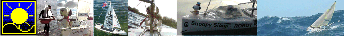
Home . About . GPS . Downloads . Business . Partners . Contact . Family . AVL . Links . History . AsOnTV . Forum
This information was copied from the front page where you should go for latest news on Snoopy and introduction to it all
Those interested in Snoopy's boat, and that built for the 2013 race should see
The Design of Snoopy Sloop ...
Those searching for Snoopy should see
The Search for Snoopy in his Robot Boat for more information
such as searches done so far.
See
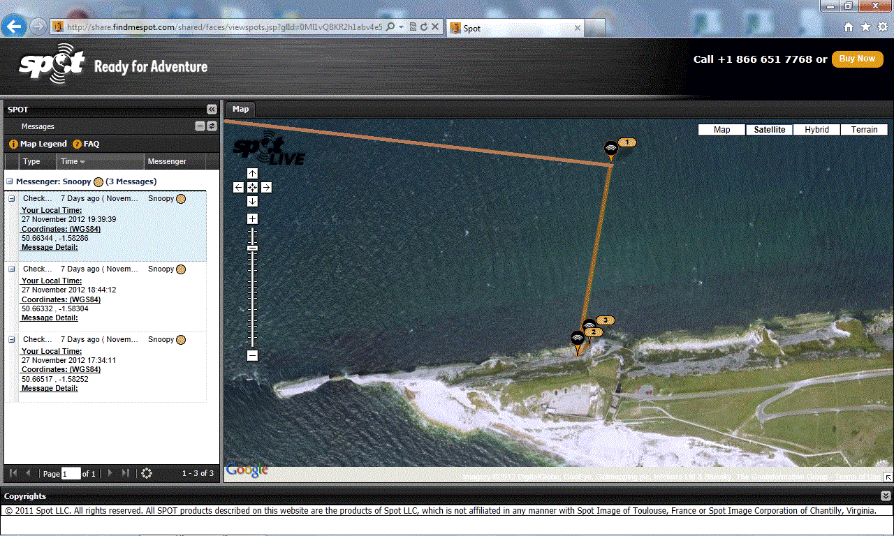
Snoopy's last position on Google Maps
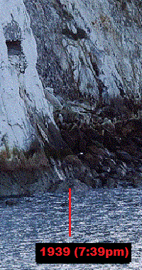
: 7:39pm Tuesday 27th, near a
military bunker
in Alum Bay.
Snoopy's track is on the
Microtransat Map*
This
SPOT Track
is from the
Mail Online.
Map
is from
SPOT
before it was automatically deleted.
Snoopy's
Track on Google Earth.
The
UK Winds and
Rain Radar
are useful to see approaching wind, rain and sunshine. The Tide and "Wind Bending" can be important.
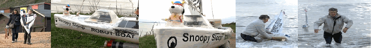
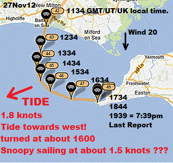
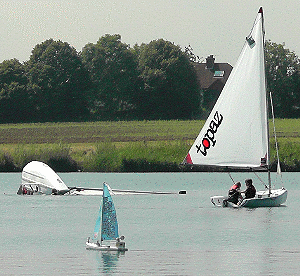
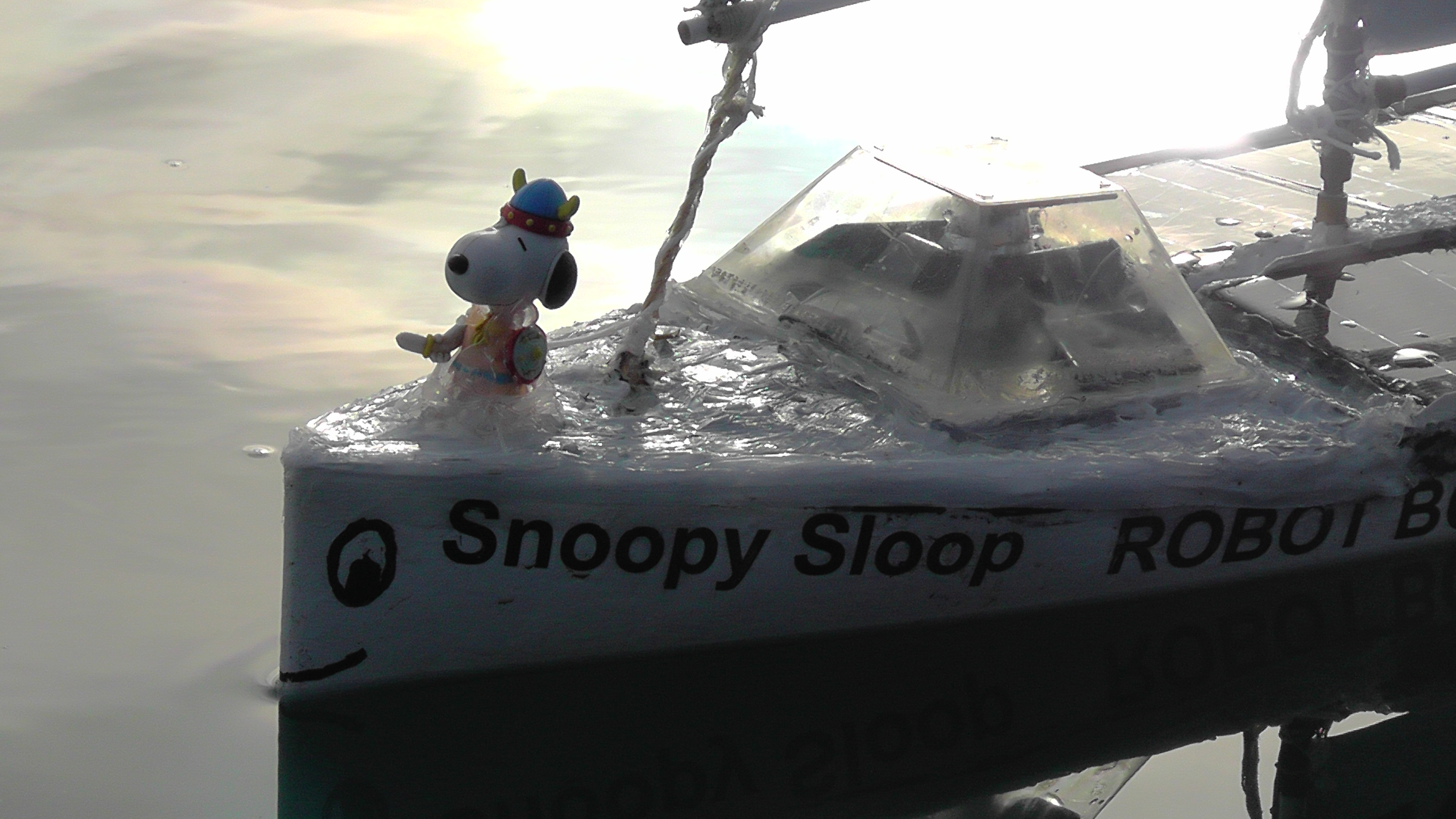
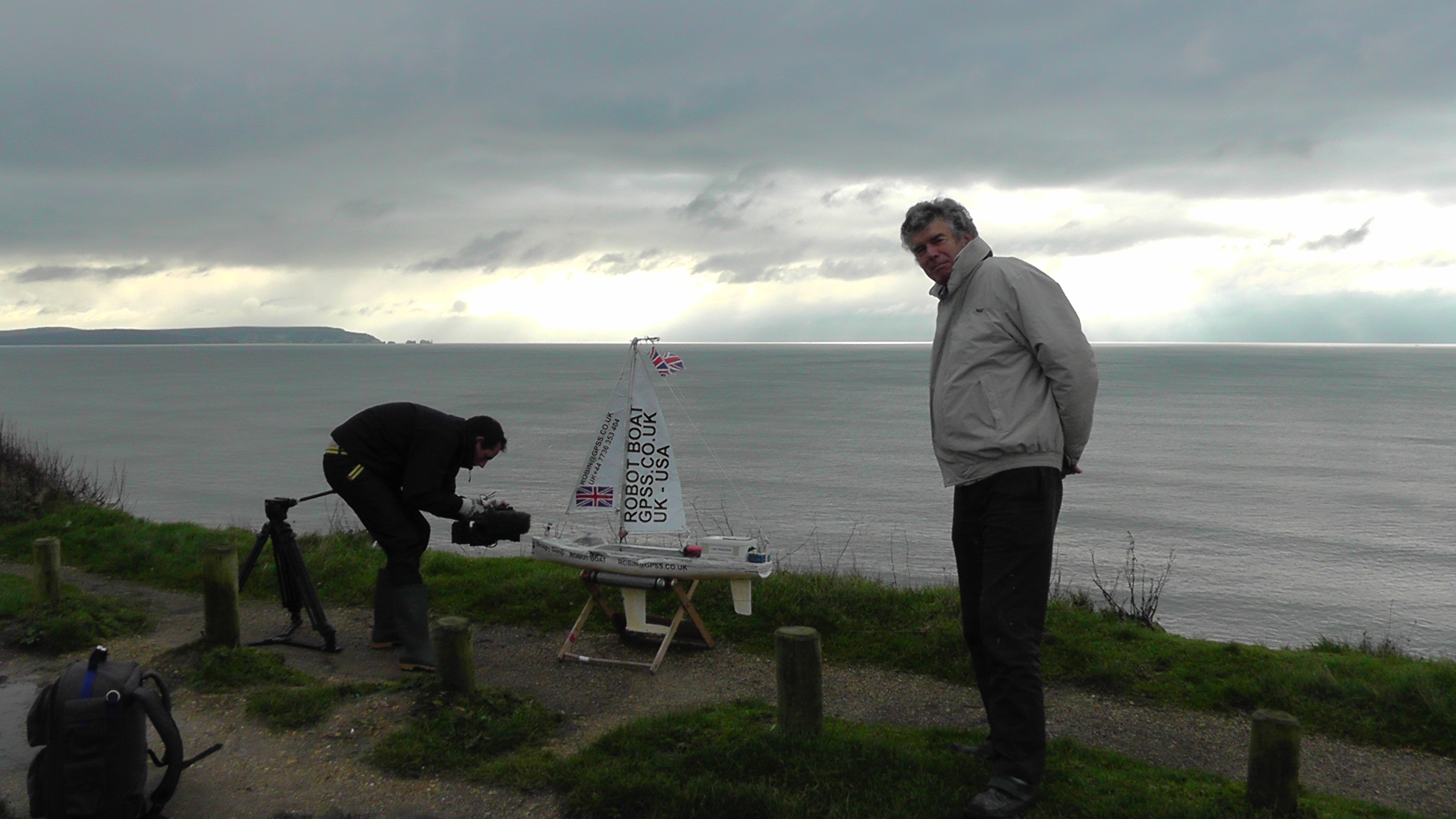
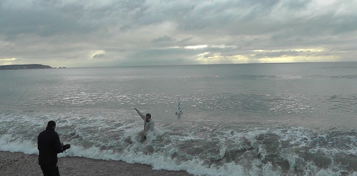
![]() Snoopy sailed from Barton at 1130am on Tuesday 27th November, was "snatched" by kayak before 2pm, then dropped near The Needles after dark.
Snoopy sailed from Barton at 1130am on Tuesday 27th November, was "snatched" by kayak before 2pm, then dropped near The Needles after dark.
Did you photograph him by accident that day ?
Know a local sea-kayaker ?
See
Robin's open letter to "Mr Snoopy-Snatcher" :-)
Beachcombers and sailors in Southampton and Isle of Wight area: keep your eye open for Snoopy - take a photo !
 Play the
video of Snoopy's launch on BBC TV South News
with Robin getting soaked,
then see our
family video of Snoopy's launch
with BBC reporters too :-)
Play the
video of Snoopy's launch on BBC TV South News
with Robin getting soaked,
then see our
family video of Snoopy's launch
with BBC reporters too :-)
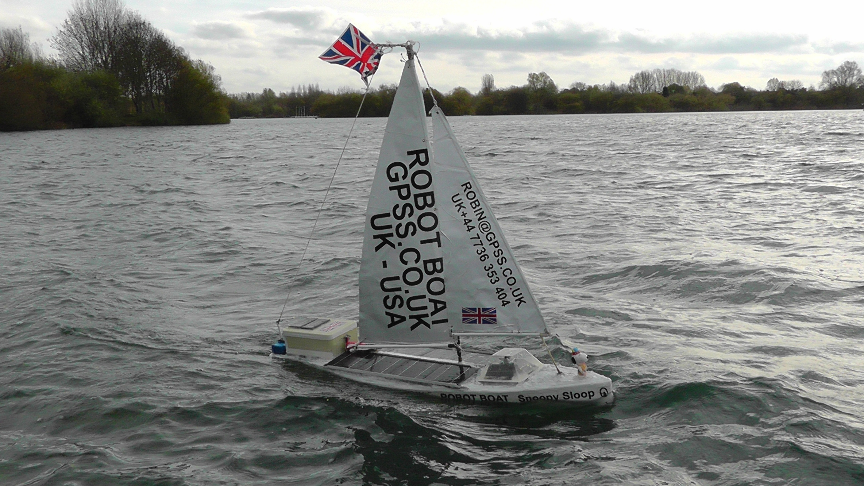
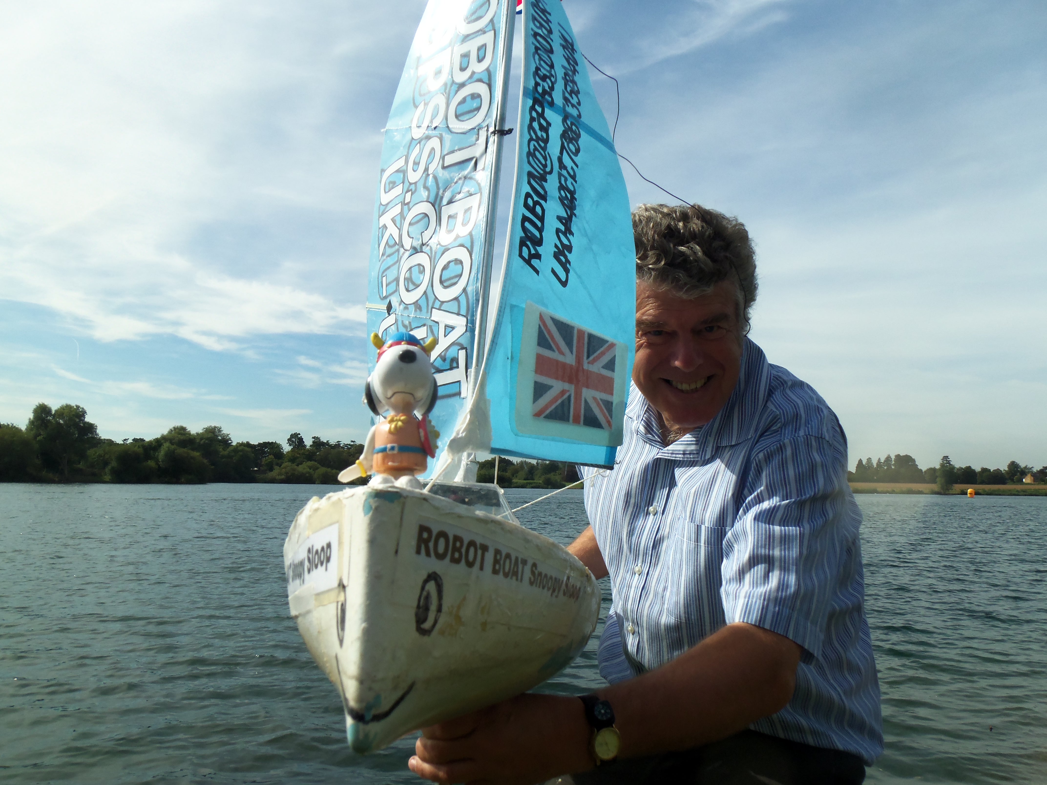
 I set up this page in early 2008, when I started this crazy hobby project: developing a small robot boat, capable of sailing itself
across the Atlantic, from UK to USA.
If you want to know more about me, our family, or my earlier defence systems career, then business,
you can start by clicking on my picture on the left, or
here. I'm Robin Lovelock, and the Press have described me as a "retired NATO scientist".
My wife June says that I retired 10 years ago !
I set up this page in early 2008, when I started this crazy hobby project: developing a small robot boat, capable of sailing itself
across the Atlantic, from UK to USA.
If you want to know more about me, our family, or my earlier defence systems career, then business,
you can start by clicking on my picture on the left, or
here. I'm Robin Lovelock, and the Press have described me as a "retired NATO scientist".
My wife June says that I retired 10 years ago !
You will find links below to amusing TV broadcasts, newspaper articles, and home videos, of Snoopy's attempt on the Atlantic in 2012. You can also read how you might help in discovering who "snatched" Snoopy, and where Snoopy went after his time on the rocks. You can read of Snoopy's plans to make another attempt in 2013.
After browsing this page and others, you can form your own opinion on myself and this rather challenging project. My local friend John told me about the friendly Microtransat international competition, and I was soon hooked. The attempts by the Welsh Team, and the French - who first suggested the idea years ago, fired my enthusiasm. Their heroic attempts only survived a few days or a few hundred miles. A journalist pointed out to me that Snoopy had sailed over 5,000 miles already, during our reliability testing of him on Bray Lake since April 2012. That's why I am confident Snoopy has as much chance as the other teams !
Next time, we shall pay more attention to Snoopy straying from his path, and photograph his captors earlier. Maybe we can arrange a suitable "Reception Committee" ? :-)
* Don't Panick!
Snoopy now appears as "disqualified" on the
Microtransat Map, as do the French.
Snoopy must be re-launched by Robin before 1st January to qualify for Microtransat 2012,
but if launched after December, he will be in next year's Microtransat 2013 race.
See "Plans for Snoopy's next attempt ..." below.
Whoever snatched Snoopy, released him again in Alum Bay. The question is then "where did Snoopy go next ?"
See
The Search for Snoopy in his Robot Boat - for more information to those helping,
such as the map showing coverage of searches done since Snoopy hit the rocks.
An important message to the sailor who "snatched" Snoopy
:
Don't worry - you must know from these pages, that I do have a sense of humour ! :-)
Even if Snoopy is now lost, it would be good to know for sure, what happened.
Unexplained things might delay Snoopy's next boat being dropped into the sea again early next year.
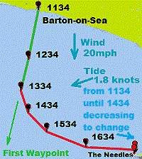
Robin is very grateful to Chris at the UKHO, who sent him detailed tidal current data by email.
The result was so dramatic that Robin had to 'phone Chris back immediately, to make sure he'd not misunderstood it.
THE TIDE WAS FLOWING TOWARDS THE WEST when Snoopy appeared to be dragged to the east, onto the Needles.
There are many good implications for this latest information. e.g. that
Snoopy was not "confused" by the tide.
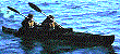
The GPS track shows that, after being "caught", Snoopy was carried at about 1.5 knots into Alum Bay.
What sails at 1.5 knots ? A sea kayak with Snoopy ? :-) It would only have taken 30 minutes
from Alum Bay or Freshwater, with the tide, to reach Snoopy - but bringing him back must have been something else !
If you know who it was, please show them this page.
Whatever they did, will not be a problem for them - in fact quite the reverse ! :-)
Please tell me of any other explanation you can think of - but please look at the evidence here first.
Here are some suggestions:
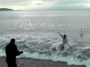
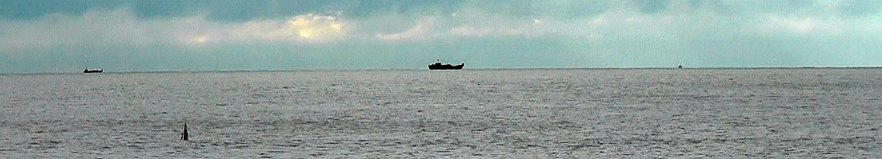
This picture below, taken at 1142, is obviously not directly relevant to photos that may show the boat that "caught" Snoopy at about 1:45pm that Tuesday afternoon.
Here, Snoopy was only about 300 yards from the shore, having only been launched 12 minutes earlier. Maybe ships, like those on the horizon,
can be used as mobile "landmarks", to get direction information on your photo, in a similar way to static landmarks like The Needles ?
But maybe the
shape
of the ship is more useful.
Suppose that ship in the middle was a
Royal Marine LCU with the AIS off ?
For those into arithmetic: there are quite a few calculations that can easily be done from that picture.
e.g. Snoopy's sail is roughly 3 metres below the horizon - which matches where we stood with our camcorder on the beach.
On the cliff, it would have been very different. Those apparent sizes of ships on the horizon should match each
other and Snoopy's sail. e.g. if that ship in the middle was a
RM LCU
of length 30m, then it would appear about that size
if it were about 3 miles out,
where Snoopy was snatched: a good time and place to drop off a kayak ?
Pity that the return trip is such a long paddle ;-)
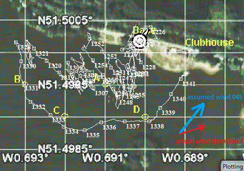
We were unable to get use of a boat, or do a "balloon test" while we had that north wind, in the first two weeks.
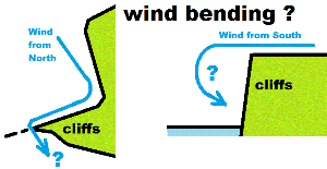
Robin's theory was that the cliffs surrounding Alum Bay may have "bent" the wind from the north, forcing it westward.
It is also possible that a south wind, spills over the cliffs, tending to keep Snoopy on that north shore.
Now that the wind has changed, here is some more detail to back up the idea, even though we gained
no further evidence to prove or disprove it. To support this new section, a recent google
on "wind bending by cliffs" found this
article.
which seems to support the theory.
Robin first thought "wind bending" might be happening the day after Snoopy hit the rocks
near The Old Battery. The detailed track is on this
Map.
It was clear what had been happening in the hours when Snoopy was being dragged
by the tide*** into Alum Bay: his autopilot was putting the rudder "hard right",
trying to steer to his waypoint 33 miles south, and he was probably turning in circles.
i.e. "confused" and resulting in simply drifting with the tide***.
But why did Snoopy suddenly appear to have succeeded in turning south, and hit the rocks ?
This is shown clearly on the
Map.
It's possible that "wind bending" can explain it: if we saw Snoopy's track in more detail (such as from his GPS logger
in the blue box at the back), we might see that he continued drifting with the tide, but suddenly turned westward,
as he got closer to the cliffs (maybe 100 yards or metres) and the wind was blowing strongly westward, against the tide.
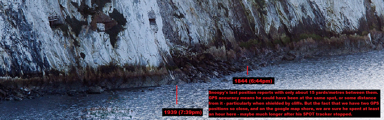
Snoopy clearly spent more than an hour on the rocks at that position, and maybe much longer after he stopped reporting.
The question is, which direction did he move after that ? Westward and past The Needles ? The tide would have helped
in this, after it turned to flow westward, later in the night.
It seems extremely unlikely that Snoopy's autopilot - and particularly the rudder - would still be working.
The rudder is sure to have been twisted or broken off during the time on the rocks.
So if Snoopy had then been blown west, and managed to get south of The Needles, through the first gap,
he would almost certainly be simply drifting downwind. i.e. to the south, blown by that north wind
that lasted for the next two weeks - with the occasional shift to blow eastward.
So, if this happened, it seems possible that Snoopy hit the French coast by now. Pity he doesn't like frogs :-)
Robin's old "on water" page, not updated for over 14 years, is
here ! :-)
It now seems Snoopy was NOT dragged east by the tide, but BY someone :-)
Snoopy was launched at 1130am Tuesday, but something* pulled him into Alum Bay, Isle of Wight.
His last report was from on the rocks at 7:39pm near an old military bunker.
* For weeks we assumed it was the tide - until we double-checked. The tide was the other way !
Was he carried in a kayak, or a slow sailing dingy ? :-)
The good news is that Snoopy Sloop worked well
- and he was very unlucky. A launch five minutes earlier*, or from further west,
and he probably would have made it past The Needles, and - with the wind behind him - out to his first waypoint.
* IF it had been the tide !
But now we know Snoopy was probably taken into Alum Bay by someone :-)
It is still possible Snoopy may be found
He might be fixed and re-launched before 1st January, to qualify for this year's race,
under the Microtransat Rules,
or be fixed to sail in next year's race - without needing to build another boat.
Even a sighting, perhaps with a photo, will be invaluable. At least we know
he's not gone off to annoy our American cousins with a "stealthy" approach to the USA :-)
Robin put local people who offered help, in touch with each other.
Others are still welcome to contact Robin by email, with a mobile number
and confirmation that OK to be put in email contact with the others, including the local Press.
Robin doesn't need the publicity, but it has been useful, as it was
for the
BBC GPS Bottles hobby project last year.
Play the
video of Snoopy's launch filmed by reporter Ben Moore and broadcast on BBC TV South Lunchtime News or
here.
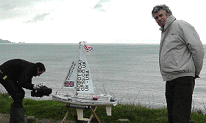
Some higher resolution pictures are below. Please email me for permission to use.
Robin welcomes more pictures, that can be used here, and given to others.
There is no longer any great rush, but it does seem that Snoopy's next attempt
could be in the Spring of 2013, such as in March or April. The 1st of April
would seem a good day - if the wind is right, and Robin's spaghetti tree is in flower.
Of course, armed with our detailed results of how Snoopy sailed on this first attempt,
we can make sure, as the launch day approaches, that we take better account of the tide,
to launch Snoopy at the right place and time - probably near the middle of the day,
and from Barton-on-Sea again, or possibly from Highcliffe.
We may even start working on yet another boat: no reason why Snoopy should not
make more than one attempt in 2013 ! :-)
See "Bright Ideas" at bottom of
The Search for Snoopy... for topics such as:
Robin received a 'phone call from a nice chap at the National Trust,
and he confirmed that the lift shafts from The Old Battery above,
can not be used - nothing in them. He confirmed that there is an area,
hidden in that photo below, extending perhaps 5 yards back to the old entrance.
Someone like a passing fisherman, seeing Snoopy's light, might have put Snoopy there, to be helpful.
This sort of thing has happened before on Bray Lake.
From Peter's photo, it looks as if the hidden area is above the high water mark.
Those searching should see the new page:
The Search for Snoopy in his Robot Boat for more information.
This includes my
contact information, such as email, land-line, and mobile 'phone
(for texting if voice is unreliable where you are).
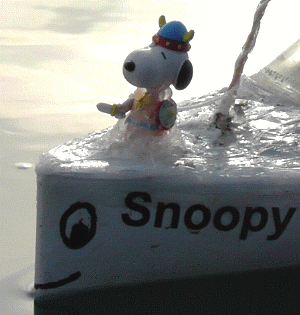
Here is Peters
picture 4631
showing the last two position reports. Snoopy checking out a military installation !
The detailed information for searchers is on the page:
The Search for Snoopy in his Robot Boat.
Simple rules for this robot boat race: get past 60W, off Bahamas;
wind power only; autonomous (GPS self guidance); must report position (GPS/Satcomms).
See
The Microtransat Challenge.
Other useful links are:
UK Winds,
World
Sea conditions
,
Temperatures
and
Sunshine.
The Welsh Team tried in 2010 and the boat sailed a few days before it was lost.
The old track of the boat is
here.
For my business partners who visit these pages... OK - I confess!
I DO spend much of my time
on this hobby project :-)
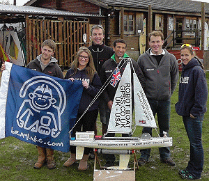
Details of our boat are on the
Microtransat Team-Joker page and below.
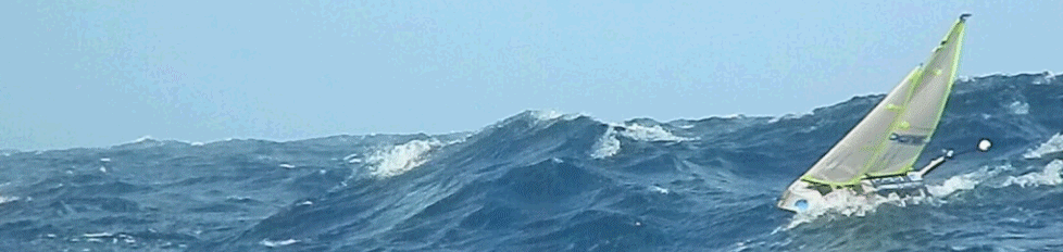
How about this for a fantastic picture from the French ENSTA-Bretagne Team - their boat braving the Atlantic waves !
Their track is
here.
See headlines above for SPOT map and latest position. These were our thoughts before launch ...
We hope to make an attempt on the Atlantic before the end of this year - IF our 24/7 tests confirm boat 8 is reliable enough to have a fighting chance !
So far .. so good ! :-)
What do we hope, fear, and expect ?
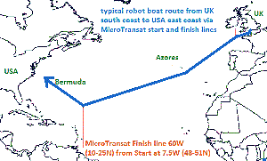
The route is from the UK south coast, into the English Channel,
west to the Microtransat start line, at 7.5W, south of Ireland, then south west to catch the trade winds.
After passing between the Azores and Madeira, Snoopy will then continue south west towards the Bahamas and the 60W
Microtransat Finish Line. Then - if he has survived these months at sea - he will contine north-west, past Bermuda
and to our chosen spot on the USA east coast. His final few miles mean passing through waypoints to miss headlands,
breakwaters and harbour walls. This landing spot will not be made public yet - we are still talking with
those near there :-) If he does make the epic journey, and lands safely, and is found by a friendly American,
he is already programmed for the return trip, with the winds behind him, eastward to Barnstaple in the UK.
The
Snoopy sails ! video
was updated on July 11th to include the sea test and boats 6, 7 and 8, steered by the new, simpler PICAXE autopilot.
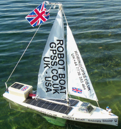
Our latest boat, number 8, is based on a 1.3m marblehead hull. See picture on right for
it fitted with #3 IOM sails and UK flag. Play
the
Robot Boat 8 video for five minutes of testing, including the
test route on 26th March, and more recent 24/7 testing.
December 2012: detail of SPOT tracker moved onto
The Design of Snoopy Sloop and Spares Needed.
page.
We have been using small sails
to get the boats to sail well in stronger winds.
So far boat 8 has coped with 30mph winds gusting to 40 in it's 24/7 tests.
The recorded
GPS plots seen below show good navigation in very light winds of 0 to 5 knots.
This includes tacking upwind to a waypoint, with the boat sailing close to 45 degrees
to the wind.
However, in stronger winds above maybe 12 knots, the tacking performance suffers,
with the 45 degrees to the wind degrading to 60, 70 or 80 degrees
- hardly making any progress up wind at all. However, even this has been sufficient
for the boat to maintain station and not drift downwind in a strong wind.
Of course, we hope to have the wind behind us most of the way ! :-)
So in summary: we are now testing the complete boat system,
hoping we will soon have the confidence it has a "fighting chance"
of surviving the many months needed to cross the Atlantic.
This could be late this year ! :-)
This information is now on the new page
The Design of Snoopy Sloop and Spares Needed.
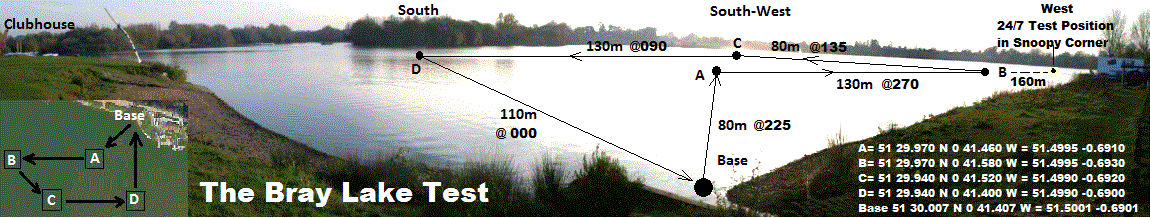
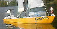
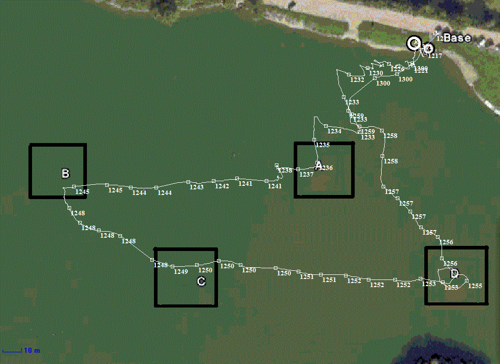
It was Friday 13th May 2011 that we first completed the test route on Bray Lake with boat 5. The autopilot was based on a Pocket PC, controlling
a wind vane that steered the boat - as on all our earlier boats since we started in 2008.
The test route is from Base, through waypoints A,B,C,D and back to Base.
Later in 2011 we began testing a radically simpler autopilot which uses
just a GPS and a small
PICAXE
processor which directly controls the rudder servo. Boat 6 (left) was built to test the new autopilot, and is just three feet long.
On Wednesday 19th October, boat 6 also completed the whole test route, and has now done this many times,
in different wind conditions.
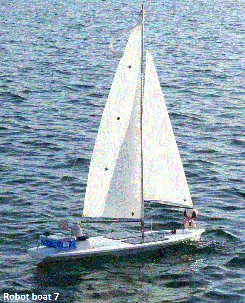
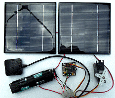
We are now working with Boat 7 (left): four foot long (1.2 metres), and wider - so it can carry enough solar panels
to power the autopilot for the many weeks or months needed for an Atlantic crossing.
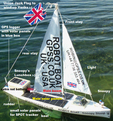
Looking at boat 7, from left to right, there is the GPS, and the blue box for picaxe autopilot and extra test hardware,
such as Pocket PC to record GPS data and speak data to shore, and another I-GotU GPS logger.
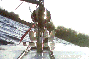
The new wind direction sensor is near the
keyring video camera,
and you can see a frame from it on the right. There is an FM transmitter below deck, and five 13cmx13cm solar panels charging 10AH of 5v batteries below.
Boat 7 has also completed the Bray Lake test, but many more tests are needed.
You can see an early GPS plot
here and a more recent one below.
We still have lots more testing to do, including the boat being able to complete the test in stronger wind conditions.
MAYBE the boats
can still make progress into the wind without knowing the wind direction ! Less bits to fail mean more reliability ;-)
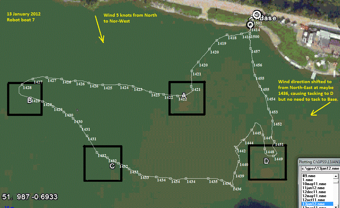
Below is a recent GPS plot of Snoopy Sloop 7 completing the Bray Lake test, in very light wind, using the wind sensor.
The updated video shows the highlights of Snoopy's epic voyage.
The GPS plot on the right may seem confusing: the first waypoint, A or "Alpha", was directly upwind, and so tacking is needed.
The same applies to the next waypoint B ("Bravo"). The result was that it took the best part of an hour to reach waypoint B, but only
ten minutes to sail to within 10 metres of waypoints C, D and back to "base" - although he chose the Clubhouse for this :-)
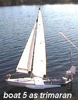
Two model aircraft floats had been added to boat 5 make it a trimaran, like boat 4. If this
had been done before boat 4 sailed in November 2009, it would not have sunk ! :-)
Recently we added another 1 kg to the 1kg keel of boat 5 - after it capsized earlier this year !
We noticed that the FM radio communications were "playing up", but this can be explained by the
batteries in the FM transmitter on the boat not having been changed in weeks - they were running flat.
Our priority now is to improve the tacking performance of boat 5 and improve on this recent success.
The main "Snoopy Sails!" video has been updated and
shows all our boats being tested, sinking, and being rescued.
The "history" has been put towards the end, and the 13th May sail
comes near to the start.
Eric's camera boat provides some of the best video.
See the 15 minute
"Snoopy sails !" video
for the successful test on 13th May and history of earlier disasters :-)
We've moved the information from here to a new page,
Robin's Snoopy Sloop robot boat - the early years, from 2008 to 2010
Where is Snoopy ?
Robin's best guess: hidden in the corner of Alum Bay, in a cave, or further east along that north coast
of the Isle of Wight, with decreasing probability.
70% chance ??? above still true for Snoopy's first two weeks on Isle of Wight while winds were from north ?
But the wind changed !
20% chance ??? that new wind has blown Snoopy onto UK mainland: Barton-on-Sea to Hurst Castle, or even to Lee-on-the-Solent ?
10% chance ??? that "wind bending" caused by cliffs, changed north wind to an east wind, and blew Snoopy past Needles ?
on the French coast ?
0.1% chance ??? that Snoopy got past Needles, with undamaged rudder and autopilot, and is on his way to annoy the Americans next year ? :-)
Searching for Snoopy ...
Who caught Snoopy
and carried him into Alum Bay ? :-)
Robin's open letter to "Mr Snoopy-Snatcher" is
here :-)
Robin noticed, rather late, that his tidal current data did not match up with the movement of Snoopy.
Why is this so important ? There were two reasons:
1. the next launch of Snoopy should be at a time when "the tide is right". It WAS right on the 27th !
2. if Robin's data was correct, then Snoopy was "stolen" by a passing boat that Tuesday afternoon ! :-)
an alternative explanation to Snoopy having been "snatched" ? :-)
 Snoopy appears to have been "snatched" at about 1:45pm Tuesday afternoon.
This was after over two hours sailing in a perfectly straight line, direction 190 degrees.
This is shown clearly on
Snoopy's
Track on Google Earth. This was about 3.1 miles / 2.6 NM / 4.9km from the shore,
if a few minutes after his 13:34 GPS position report.
Snoopy appears to have been "snatched" at about 1:45pm Tuesday afternoon.
This was after over two hours sailing in a perfectly straight line, direction 190 degrees.
This is shown clearly on
Snoopy's
Track on Google Earth. This was about 3.1 miles / 2.6 NM / 4.9km from the shore,
if a few minutes after his 13:34 GPS position report.
But please keep the ideas coming :-)
Hardly likely - I've tested it against our GPS Bottle tests in 2011. The UKHO would have very red faces :-)
Hardly likely - the few hours in wind of 20mph was far less than the many weeks of 24/7 tests in winds of up to 50mph.
Sounds plausible - but does anyone know of an article that confirms and quantifies this effect - if it exists ?
recognition of shipping using photographs and AIS data...
 Suppose you have a photo: maybe taken near the beach that Tuesday afternoon, and in the background there is the sea, with perhaps
a blurred speck that might be a kayak or small sailing dingy - skippered by "
Mr Snoopy-Snatcher
" .... we might be able to match that speck with where Snoopy was at that time, from Snoopy's known GPS track. We will also need the
time of the photo (e.g. from the file name or PC properties of the digital picture), and where the camera was (e.g. by looking on
google maps
and doing a right click, then "What's Here?" to get the lat/lon. e.g. 50.7344,-1.6577.
Suppose you have a photo: maybe taken near the beach that Tuesday afternoon, and in the background there is the sea, with perhaps
a blurred speck that might be a kayak or small sailing dingy - skippered by "
Mr Snoopy-Snatcher
" .... we might be able to match that speck with where Snoopy was at that time, from Snoopy's known GPS track. We will also need the
time of the photo (e.g. from the file name or PC properties of the digital picture), and where the camera was (e.g. by looking on
google maps
and doing a right click, then "What's Here?" to get the lat/lon. e.g. 50.7344,-1.6577.
![]() Here is an
AIS map
which shows you what is available.
Historical AIS
(
Automatic Identification System
)
might help us.
If you look at this
wider AIS map
you can see ships such as
ABIS Belfast
, 27 miles out. This ship is 89m long.
But how much would we have seen above the horizon at 27 miles ? Maybe not ! :-)
Here is an
AIS map
which shows you what is available.
Historical AIS
(
Automatic Identification System
)
might help us.
If you look at this
wider AIS map
you can see ships such as
ABIS Belfast
, 27 miles out. This ship is 89m long.
But how much would we have seen above the horizon at 27 miles ? Maybe not ! :-)
![]() Can you do better than Robin with these links ? Right now he's not managed to find ships that
match this picture in apparent size according to their distance away.
Can you do better than Robin with these links ? Right now he's not managed to find ships that
match this picture in apparent size according to their distance away.
If we can, then maybe AIS data can be used to help calibrate any photos that come in which may show Snoopy being carried to Alum Bay by kayak :-)
"Wind Bending" ? more detail on Robin's theory ...
 *** below was written before we realised it was not the tide that dragged Snoopy into Alum Bay
- because the tide was towards the west !
*** below was written before we realised it was not the tide that dragged Snoopy into Alum Bay
- because the tide was towards the west !
Earlier News about Snoopy and links to BBC TV News videos, etc ... updated !
 Snoopy then stopped reporting.
He may have sailed over 5000 miles on Bray Lake this year, in winds over 50mph, but waves onto
hard rocks are something else ! :-) Snoopy's "lunchbox" probably got damaged and
water reached his electronics, stopping his GPS position reports.
Snoopy then stopped reporting.
He may have sailed over 5000 miles on Bray Lake this year, in winds over 50mph, but waves onto
hard rocks are something else ! :-) Snoopy's "lunchbox" probably got damaged and
water reached his electronics, stopping his GPS position reports.
 Hindsight is a Great ! But see my words, published here before launch, under "Launch before Christmas..." below.
e.g. "We fear our simple GPS autopilot may be confused by the effect of tide...". GPS/Tide/Wind data was analysed for this.
I guess Snoopy was NOT confused by the tide: he simply failed to "repel boarders" :-)
Hindsight is a Great ! But see my words, published here before launch, under "Launch before Christmas..." below.
e.g. "We fear our simple GPS autopilot may be confused by the effect of tide...". GPS/Tide/Wind data was analysed for this.
I guess Snoopy was NOT confused by the tide: he simply failed to "repel boarders" :-)
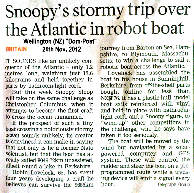
TV videos and What the Papers say ... Don't believe all you read in the papers :-)
Then see our
family video of Snoopy's launch - with Ben getting wet too !
Read
Jasper Coppings article in the Sunday Telegraph the Sunday before launch.
Read recent BBC News report of "crash landing"
here
or
Nice pictures and amusing words in
The Mail Online here :-)
The news about Snoopy even got as far as New Zealand, in the Wellington,NZ
Dom-Post article :-)
First paper:
Snoopy prepared for self-navigating Atlantic voyage by Paul Miles in Maidenhead Advertiser on 5th September 2012.
Journalists may have started with our
Press Release and
video,
but editors need to edit : the meaning may not remain the same :-)
more pictures for the Press ...
Snoopy,
Mug,
Boat,
Robin,
BenTV,
Launch,
TimRobin,
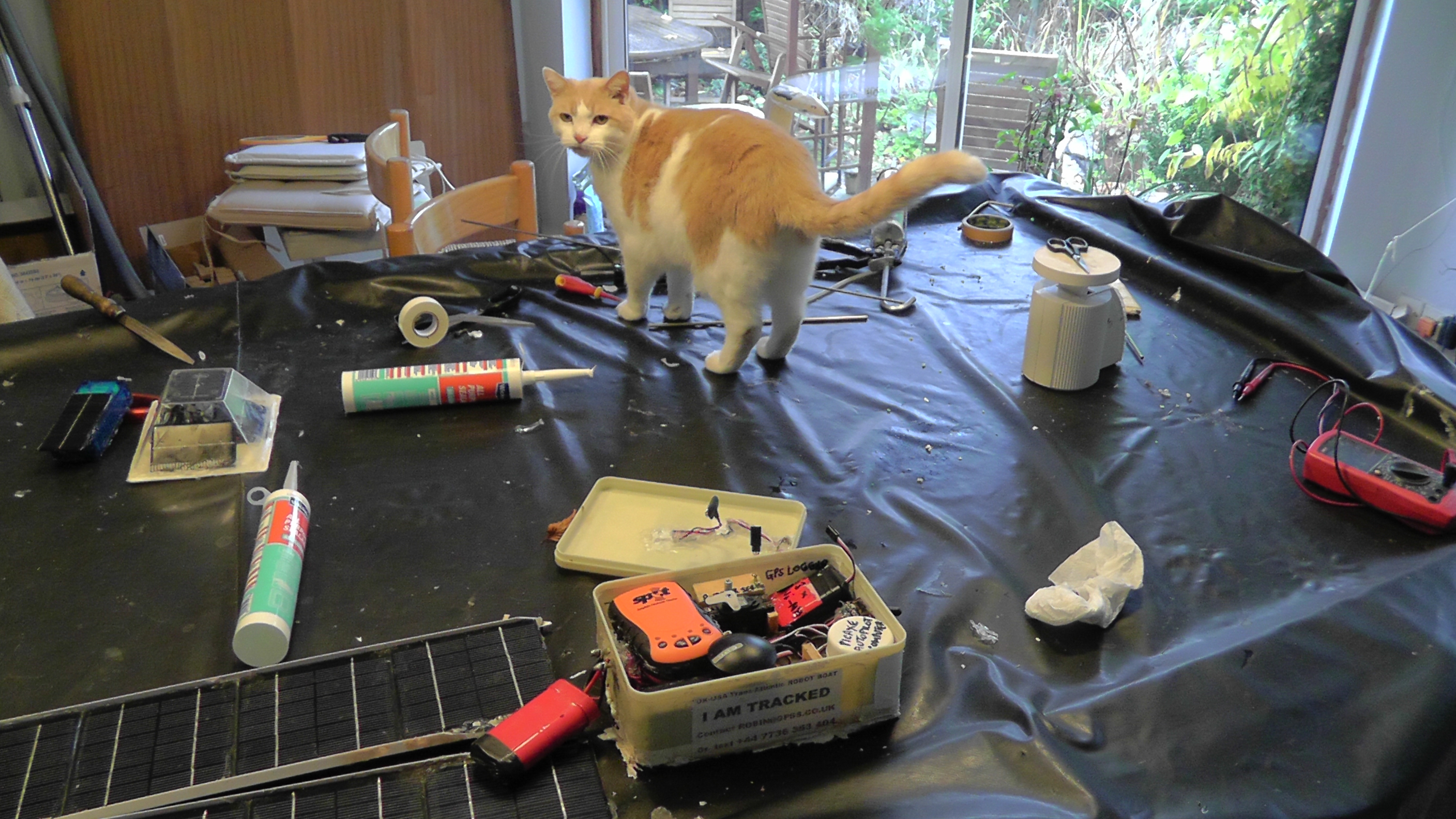
Cat - Cat added 8th Dec.
(please ask permission to use by email to Robin)
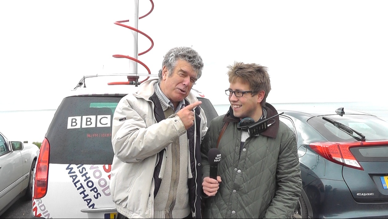
Robin says to
Tim Robinson, the Reporter on the Water for
BBC Radio Solent
, "This is the guy who lost one of my GPS bottles last year !" :-)
Robin thanks his friends ...
"Can you help Robin find Robot boat Snoopy? See www.gpss.co.uk/autop.htm if you can help. Last seen near The Needles."
Robin, despite his name, cannot Tweet. Please take care what you tweet, so as not to encourage others to take risks.
Plans for Snoopy's next attempt in early 2013 ...
 Robin is already gathering the parts for Snoopy's next boat, assuming that this Snoopy-Sloop is not found soon.
The next boat will be exactly the same well tested
design and is intended to compete in the "Microtransat 2013" race.
The present plan is for the following:
Robin is already gathering the parts for Snoopy's next boat, assuming that this Snoopy-Sloop is not found soon.
The next boat will be exactly the same well tested
design and is intended to compete in the "Microtransat 2013" race.
The present plan is for the following:
more detail for those helping to find Snoopy ...
 More information was added to help anybody searching, including by boat.
This information and advice exploits the excellent photo recce and analysis
performed by Peter, providing detailed coverage of Alum Bay, including where
Snoopy last reported - near to the entrance of that old military bunker !
More information was added to help anybody searching, including by boat.
This information and advice exploits the excellent photo recce and analysis
performed by Peter, providing detailed coverage of Alum Bay, including where
Snoopy last reported - near to the entrance of that old military bunker !
Better Tide and Wind data ?
, for planning a re-launch of Snoopy, and predicting where his boat went.
Party Balloons across Alum Bay ?
- Daft? Could be useful! Cliffs made a north wind go west ?
Quadrocopters ?
use of Radio or GPS Controlled model aircraft for photo-recce ?
Know local fisherman ?
Is that a fishing net to the left of
Snoopy's last position on Google Maps ?
 Please don't send Robin hoax emails, pretending to find the boat, as someone did one Thursday afternoon.
Maybe we will tell you more about this chap in a few days, but we don't want to distract our searchers now.
If anyone does find Snoopy, Robin will want to speak on the 'phone urgently ;-) He will want to know your
full name,
'phone number, and if it is OK to put you in touch with the others helping to find and recover Snoopy, including the BBC.
If you don't want to be on Radio or TV, that's OK - but Robin needs to know.
Please don't send Robin hoax emails, pretending to find the boat, as someone did one Thursday afternoon.
Maybe we will tell you more about this chap in a few days, but we don't want to distract our searchers now.
If anyone does find Snoopy, Robin will want to speak on the 'phone urgently ;-) He will want to know your
full name,
'phone number, and if it is OK to put you in touch with the others helping to find and recover Snoopy, including the BBC.
If you don't want to be on Radio or TV, that's OK - but Robin needs to know.
See
Fortifications of the Isle of Wight - The Needles Old Battery.
Readers may want to read this, and talk of the two Hotchkiss 6-pounder quick firing guns and a Maxim machine gun.
We hope that they hold fire during any close recce boat approaches, as they did when Snoopy visited ! :-)
Thanks to the National Trust, who now own this site, we now know the only access to this spot is from the sea.
Also that there IS a hidden area, extending about 5 yards back.
from the earlier introduction at the top of this page ...
The French Team made an attempt in 2011 and it sailed for a few days in heavy seas before a sail broke. But they
recovered the boat and tried again!
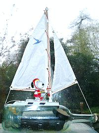
Do not be confused by the picture of Snoopy sailing the bottle:
that was from the
GPS bottles in the sea
projects :-)
Play the
"Snoopy sails !" video
- updated July 2012 to include progress with boats 6, 7 and 8, and sea test.
This also shows over four years of robot boat work - including sinkings and rescues :-)
For our latest prototype, see the 5 minute
Robot Boat 8 video - May 2012 - with 24/7 testing.
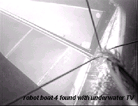
More details of underwater TV recce/winch boat used in 2009 is in the 5 minute
"Rescue of Snoopy" video
Play the 3 minute video
Robot Boat Sounds: past, present and future September 2012 Text-To-Speech.
the Bray Lake Test ... sail 530 metres automatically, through 5 waypoints ...
launch before Christmas to attempt the Atlantic crossing from UK to USA ? ...
getting ready to attempt the Atlantic crossing ...

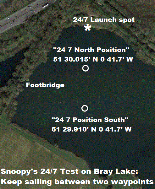
 Our 24/7 tests of boat 8 (see right), were started in April and continue on Bray Lake. Snoopy can do the test route in less than 30 minutes,
in a light wind of 5mph. He can maintain station on the 24/7 waypoint, in the corner of Bray Lake, for days,
including in winds of 20mph gusting to 30. Countless minor problems are being found and fixed, including
water leaks, sails breaking, and full recovery from power failure if not enough sunshine. If wind drops
to below 2mph, Snoopy drifts, as we would expect (the GPS cannot give accurate direction), but this
is not considered a problem in the Atlantic: it is simply a minor inconvenience on Bray Lake - which is a lot smaller :-)
Our 24/7 tests of boat 8 (see right), were started in April and continue on Bray Lake. Snoopy can do the test route in less than 30 minutes,
in a light wind of 5mph. He can maintain station on the 24/7 waypoint, in the corner of Bray Lake, for days,
including in winds of 20mph gusting to 30. Countless minor problems are being found and fixed, including
water leaks, sails breaking, and full recovery from power failure if not enough sunshine. If wind drops
to below 2mph, Snoopy drifts, as we would expect (the GPS cannot give accurate direction), but this
is not considered a problem in the Atlantic: it is simply a minor inconvenience on Bray Lake - which is a lot smaller :-)
 We did our first sea test with boat 6, on Sunday 8th July, from the beach near Barton, east of Bournemouth.
There were no "bad surprises" and the test confirmed these small boats sail on waves as they have on Bray Lake.
The software inside our little �10 picaxe computer now has a route programmed, and being tested on a GPS simulator at home.
The same software is running inside the boat on Bray Lake.
We did our first sea test with boat 6, on Sunday 8th July, from the beach near Barton, east of Bournemouth.
There were no "bad surprises" and the test confirmed these small boats sail on waves as they have on Bray Lake.
The software inside our little �10 picaxe computer now has a route programmed, and being tested on a GPS simulator at home.
The same software is running inside the boat on Bray Lake.
 We are doing 24/7 testing at a waypoint in the corner of Bray Lake.
This is helping us solve
basic problems like finding leaks and proving the total boat system,
including solar panel based power systems, GPS-PICAXE-rudder servo autopilot,
SPOT tracker, and the boat itself.
The SPOT tracker enables us to monitor the boat from home - particularly if it runs aground.
See the
SPOT map
for recent position reports.
Click on [satellite] to see map with trees, club house, etc.
We are doing 24/7 testing at a waypoint in the corner of Bray Lake.
This is helping us solve
basic problems like finding leaks and proving the total boat system,
including solar panel based power systems, GPS-PICAXE-rudder servo autopilot,
SPOT tracker, and the boat itself.
The SPOT tracker enables us to monitor the boat from home - particularly if it runs aground.
See the
SPOT map
for recent position reports.
Click on [satellite] to see map with trees, club house, etc.
what bits have we used and where did we get them ? ...
earlier news from 2011: Snoopy sails the course ...
 The boats need to be able to tack towards the wind, and we are now using a
wind direction sensor - see picture on right
and more detail on the
Ametes direction sensor.
The boats need to be able to tack towards the wind, and we are now using a
wind direction sensor - see picture on right
and more detail on the
Ametes direction sensor.
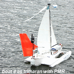
 Boat 5 also has solar panels. Boats 4 and 5 have a choice of three sail sizes:
largest (IOM #1), medium (#2), and smallest (#3 storm) rig. The FM radio
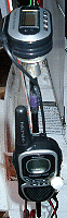
for ship-shore computer voice communications in addition to PMR (see right) works well.
Boat 5 also has solar panels. Boats 4 and 5 have a choice of three sail sizes:
largest (IOM #1), medium (#2), and smallest (#3 storm) rig. The FM radio
for ship-shore computer voice communications in addition to PMR (see right) works well.
2009 & 2010: Snoopy sinks, is recovered, sails again and boat 5 is launched ...
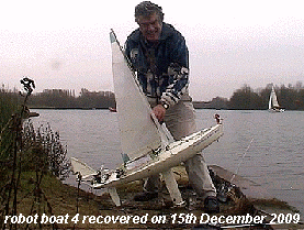
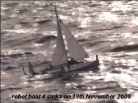 Snoopy Sloop 4 sank below the waves on 19th November 2009.